METAR Code
TS
Weather Symbol

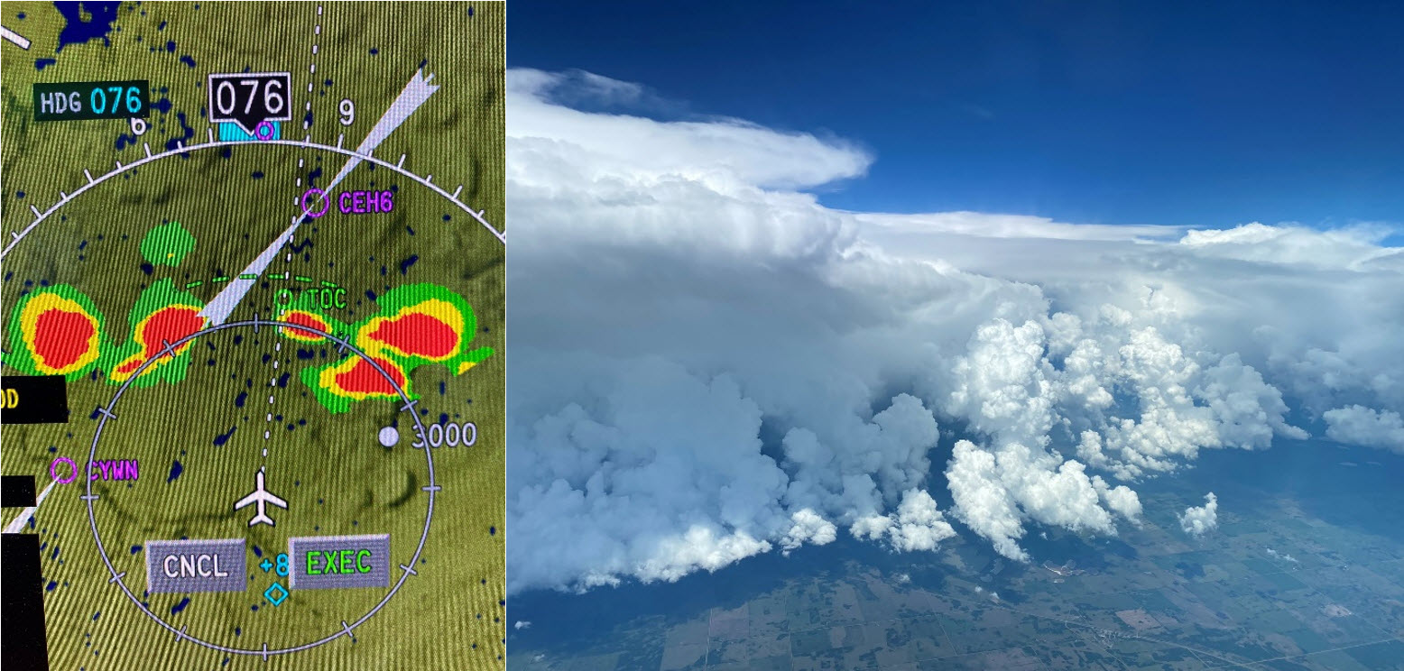
Thunderstorms can cause a suite of impacts including:
A storm with thunder and lightning that is typically accompanied by heavy rain, gusty winds, and sometimes hail.
Associated terms coming soon:
Dewpoint, inversion, lake breeze, low-pressure system, mesoscale, orographic lift, tornado, and upslope flow are all terms associated with thunderstorms that will be coming soon to the Aviation Meteorology Reference.
Thunderstorms require three main ingredients for formation: moisture, instability and a trigger. A fourth ingredient, wind shear, though not necessary for thunderstorm development determines the type of thunderstorms that will develop. Thunderstorms that develop in low or no wind shear environments tend to be non-severe whereas severe thunderstorms are more likely to develop when wind shear is present.
This image is a Venn diagram showing the necessary ingredients for thunderstorm development. Non severe thunderstorms can develop when the first three ingredients (instability, moisture and a trigger) are present. For severe thunderstorms to develop, wind shear is also necessary.
Moisture
Moisture is the main energy source for thunderstorm development. Warm, moist air is more buoyant and less dense than cooler, dryer air. As this air rises and condenses, thunderstorms can develop and the continuous supply of heat and humidity allows them to persist longer. Forecasters look for moisture in a variety of ways, including looking for high dew point temperatures, morning fog/dew, and onshore flow from water sources, among others.
Instability
Instability is the second ingredient necessary for thunderstorm formation. Instability allows for warm moist air to rise into the upper levels of the atmosphere. The more unstable the atmosphere is, the more momentum air will have as it rises vertically in the air, meaning the thunderstorms create a stronger updraft that will help fuel the thunderstorms. More detail on instability can be found under the term “atmospheric instability”. Instability is assessed through use of weather balloon data, as well as scientific reasoning.
Trigger
The third ingredient necessary for thunderstorm development is a trigger. A trigger initiates or “kicks off” the vertical motion of the air in the atmosphere and thunderstorms begin to develop. A front, trough, lake-breezes, topography, and even daytime heating from the sun can all act as triggers to initiate thunderstorm development. The type of trigger does have an effect on the type of thunderstorms that will develop. Fronts will activate thunderstorms and push them along in an organized line, whereas triggers like daytime heating generally create more disorganized, isolated storms.
Wind Shear
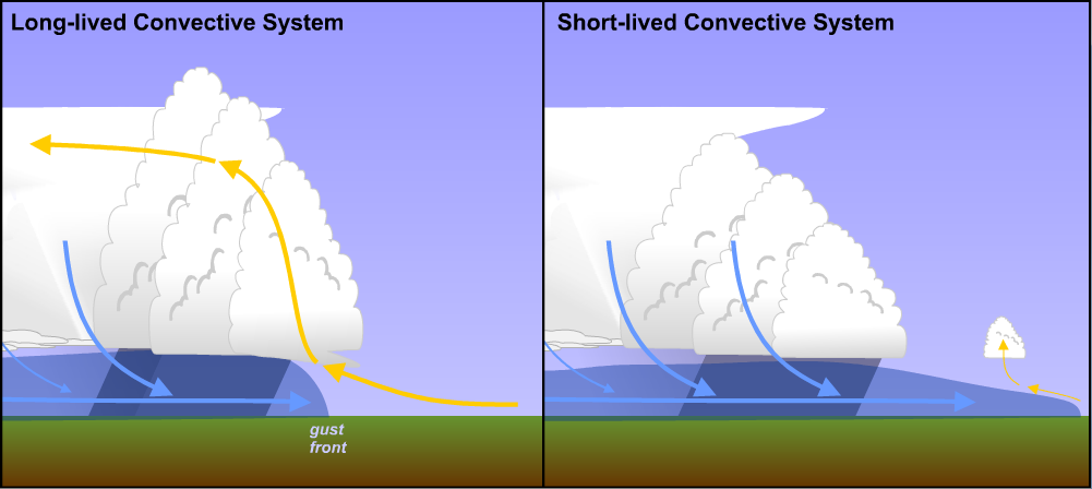
Wind shear, which is the change in wind speed and wind direction with height, is one of the main ingredients that determines what type of storms will form and how long they will last. Its main effect is to tilt and rotate the cloud in such a way that the updrafts, which feed the thunderstorm with heat and moisture, become separated from the downdrafts. This prolongs the lifespan of these systems, and allows them to develop and intensify into more complicated and powerful structures.
For more information on how shear impacts convective systems, please refer to The COMET Program’s course: MetEd / Principles of Convection III: Shear and Convective StormsOpen a new window.
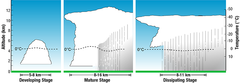
Image Source: Environment and Climate Change Canada
This image presents the three stages of development of a thunderstorm. In the developing stage, warm moist air begins to rise and condense. This forms the updraft region of the thunderstorm. In the mature stage, water droplets begin to form, and some begin to fall back down to the ground dragging cooler air from the upper levels of the atmosphere back down to the surface. In the dissipating stage, the updraft region gets cut off and the downdraft takes over. With no more energy feeding into the thunderstorm, it soon dissipates.
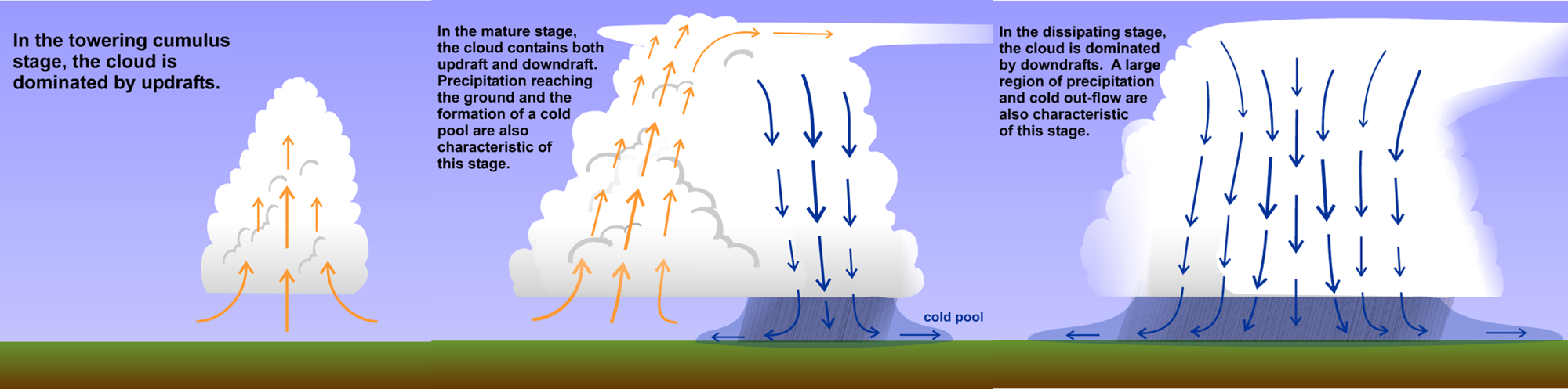
There are two main regions of a thunderstorm – an updraft and a downdraft.
The updraft region is characterized by warm, moist air rising vertically and being ingested into the thunderstorm. Maintaining the updraft region is necessary for thunderstorms to continue, as it provides the “fuel” into the storm, which generates precipitation. If this source of energy gets cut off, the thunderstorms enter the dissipation phase and fizzle out.
The downdraft region, however, is characterized by cooler air that descends from the upper levels of the atmosphere back down to the surface, bringing gusty winds and precipitation. As the cold air falls to the surface, it spreads out on the ground generating a “cold pool” of air and extending away from the cell, also called a gust front. Once the downdraft region dominates in the thunderstorm life cycle, it will eventually cut off the energy supply of the updraft region and the thunderstorm will begin to dissipate. The downdraft can also be forceful enough to generate gusty winds at the surface with any kind of thunderstorm, but tend to be more severe in thunderstorms that form in a wind shear environment.
The mix of updrafts and downdrafts within the system are what leads to turbulence within convective clouds. The stronger the up and downdrafts are, the more intense the in-cloud turbulence will be.
Additionally, icing conditions are likely in convective clouds, generally in the top-few thousand feet. This is because warm air is pulled up higher into the atmosphere, lifting the freezing-level.
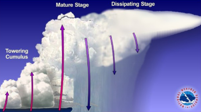
Image Source: National Severe Storms Laboratory (NSSLOpen a new window)
A single cell thunderstorm is one that has a single updraft and downdraft. They often occur in low/no wind shear environments, meaning their updraft and downdraft are not rotated away from each other, and are more or less vertically stacked and working against each other. They usually form due to daytime heating on a hot summer day, are short lived, lasting typically an hour or less due to the downdraft acting against the updraft once the storm matures. Single cell thunderstorms typically remain sub-severe and have a structure similar to the image shown here.
When single cell storms do occur in environments with wind shear, they will persist for up to an hour. The figure shown here depicts the idealized life cycle of a single cell storm. Initiation (left) stages are dominated by updrafts forming the convective cloud, lifting moisture through an unstable atmosphere as initiated by a trigger. The mature stage (center) occurs when the storm is precipitating, and the up and downdrafts coexist. Dissipation (right) begins when the warm air taken in by the updraft is cut off, and the system begins to degrade.
Image source: Penn State Department of Meteorology and Atmospheric ScienceOpen a new window
Multi-cell thunderstorms consist of many single-cell thunderstorms, each with their own updraft and downdraft structure that interact with each other to form new storms. They typically develop in environments where there is some wind shear (usually “speed shear”: a change in wind speed, but not direction, with height), which tilts the updraft and downdraft away from each other in each of the single cells. Multi-cell thunderstorms can last for many hours as the updrafts and downdrafts interact with each other in different stages of a thunderstorm life cycle to form new thunderstorms.
This is an example of a multi-cell thunderstorm. On the left, we can see towering cumulus forming, each with its own updraft and in a different stage of thunderstorm development. In the middle of the diagram, these storm cells have matured, and precipitation has begun to fall back to the surface creating a downdraft. On the right, these cells are in the dissipating stage and precipitation is no longer present.
Image source: NOAA/NWS
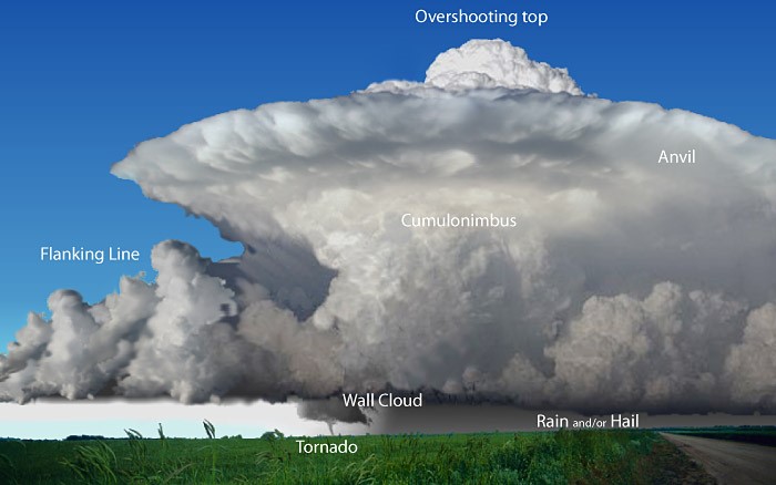
This image shows the main features of a supercell thunderstorm. A supercell thunderstorm is a type of severe thunderstorm that is characterized by its long-lasting and rotating updraft, which is called the mesocyclone. Supercells are usually the most dangerous type of thunderstorm, and they can produce a variety of severe weather events such as large hail, damaging winds, tornadoes, and flash floods.
Supercell thunderstorms form in highly unstable environments with fairly strong directional and speed wind shear. The increase in wind speed with height, in combination with wind veering (turning clockwise) with height produced a rotating updraft, which can lead to tornadoes. This shear environment also tilts the cumulonimbus cloud, maintaining separated up- and downdrafts, and prolonging the storm’s life.
Image source: NOAA/NWS
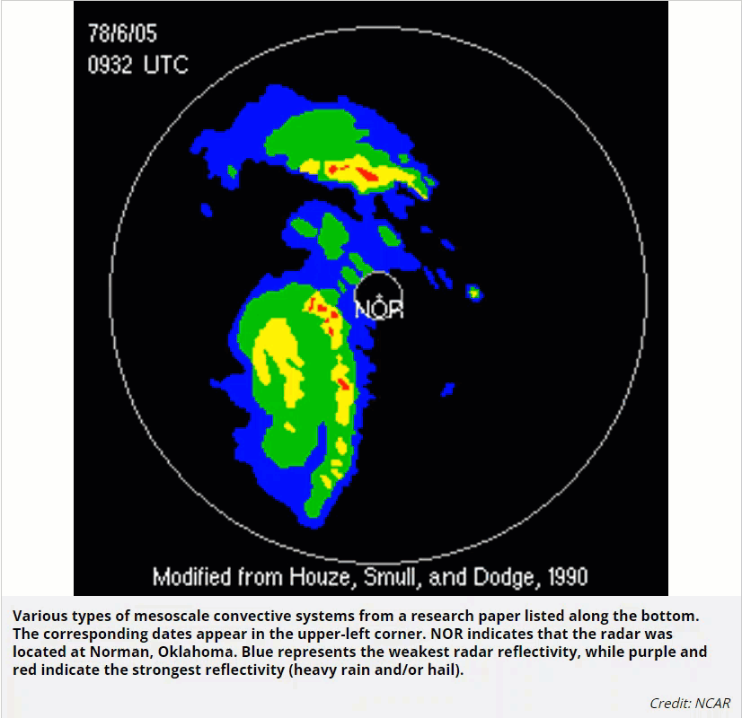
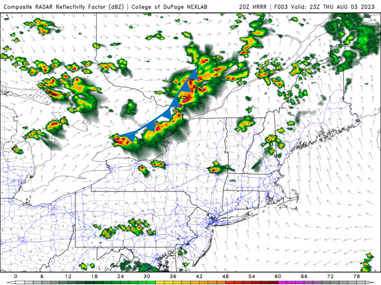
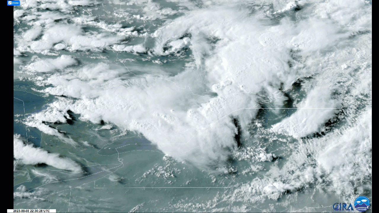
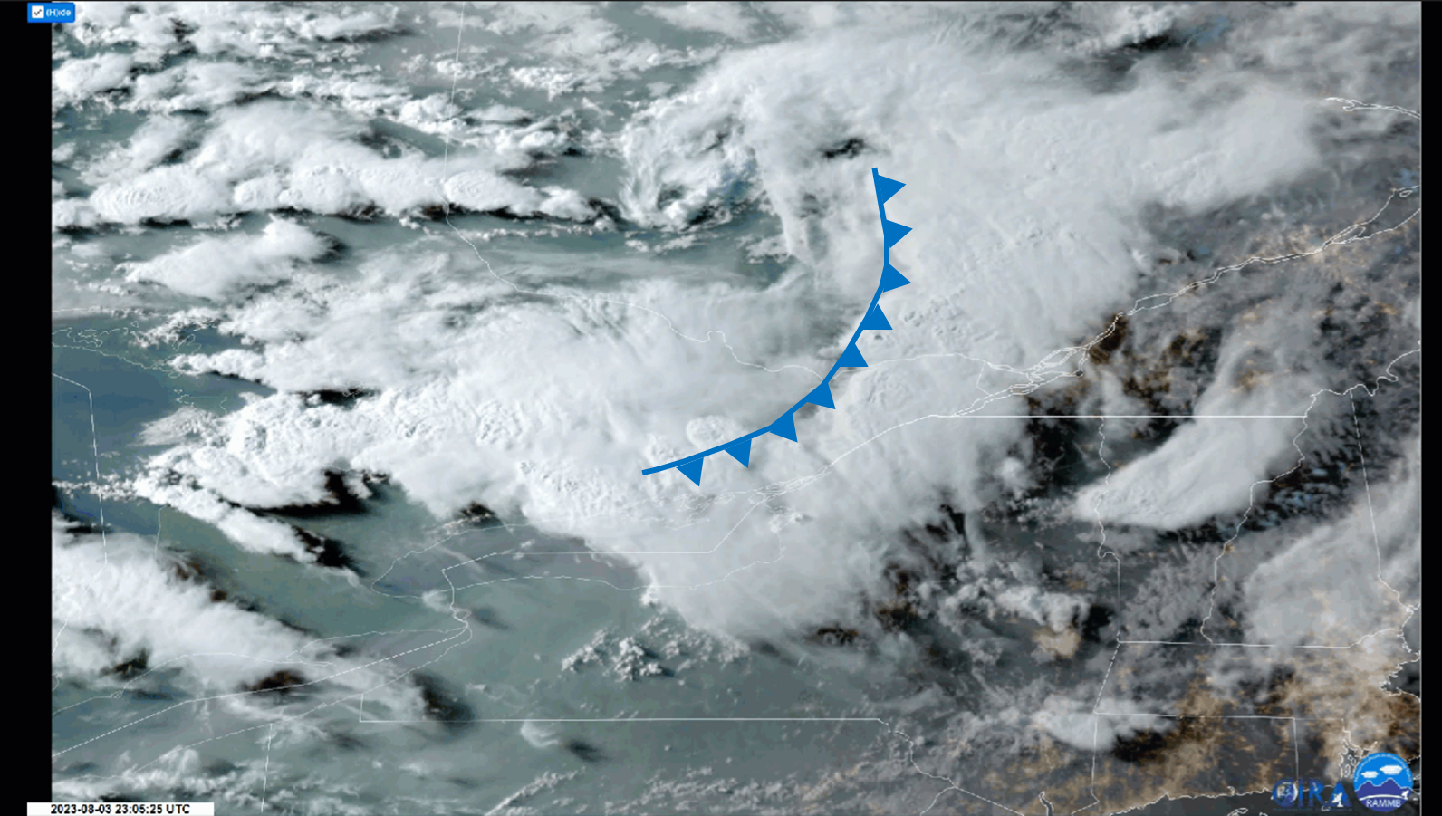
Mesoscale Convective System is an umbrella term for large (mesoscale) groups of thunderstorms acting together, with very long lifespans. These systems are made up of several single-, multi-, and/or supercells, and can cover hundreds of kilometers of space. They develop in sheared wind environments, which can extend the lifespan of these storms as high as 12 hours or more. Some convective systems which fall into this category are squall lines, derechos, and mesoscale convective complexes. To explore MCSs further, please refer to The COMET Program’s course: Severe Convection: Mesoscale Convective SystemsOpen a new window
Image Source: COMET