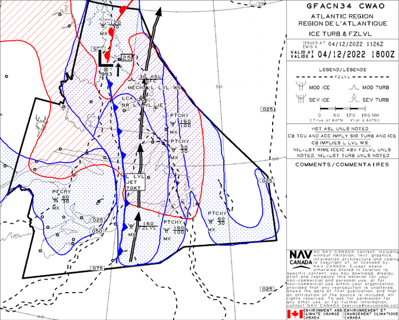
METAR Code
WS
Weather Symbol
The local variation of the wind speed and/or direction over a relatively small vertical distance above the ground, causing the rapid gain or loss of air speed (typically over a short distance).
Associated terms coming soon:
Inversion, low-pressure system, and wind channeling are all terms associated with low-level wind shear that will be coming soon to the Aviation Meteorology Reference.
A low-level wind shear environment is created when there are significant differences in wind over a small vertical distance. Wind shear is usually categorized as being speed shear or directional shear (third image in this carousel), although they can occur at the same time.
Low-level wind shear scenarios can form under a variety of conditions that exacerbate the difference in low level winds, such as:
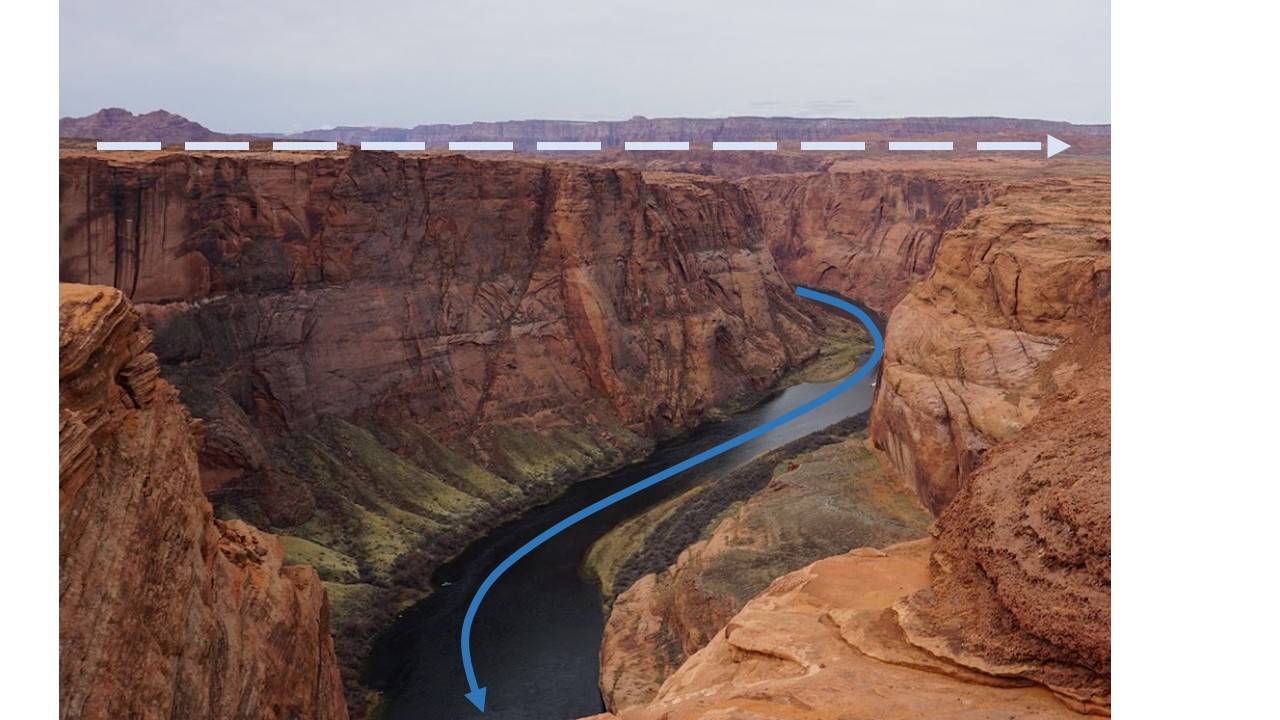
This image is an extreme example of low-level wind shear as caused by surface winds channeled through a valley, while synoptic level winds aloft flowing free of terrain restriction, with the large-scale wind pattern. With strong enough winds, the abrupt change in wind direction in such a small vertical space due to terrain forcing is an excellent example of low-level wind shear.
Image Source: Environment and Climate Change Canada
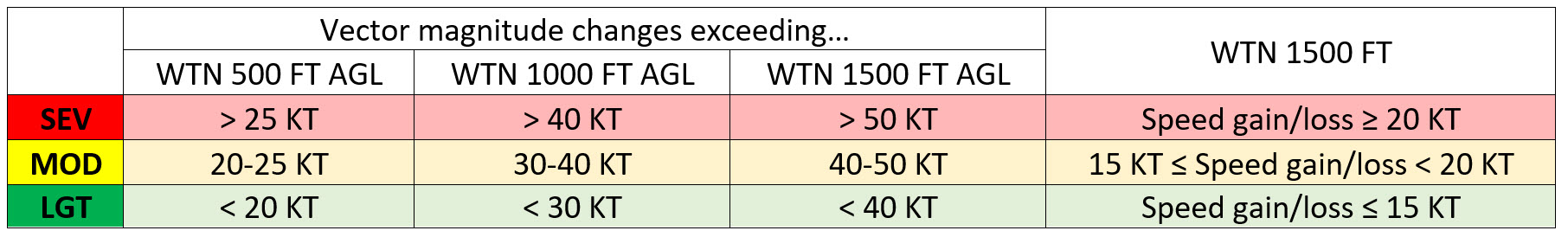
This table is the low-level wind shear extremity chart from MANAIR 2.6.9.
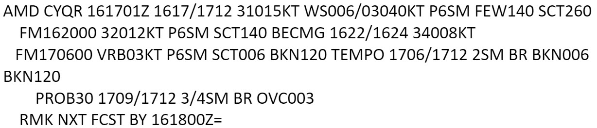
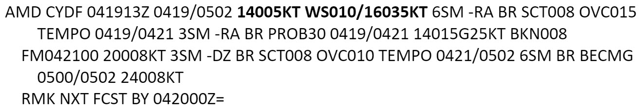
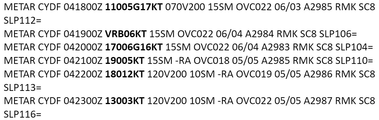
Convection (thunderstorms, or towering cumulus clouds causing precipitation) can cause low-level wind shear as well through strong downdrafts. For example, within the leading edge of a gust front associated with the strong downdraft of a thunderstorm often creates a low-level wind shear environment. It is important to note however, that a low-level wind shear group in a TAF does not represent convection-generated wind shear. Wind shear groups in the TAF only cover non-convective low-level wind shear within 1500ft AGL.
Since small changes in wind speed and direction are common in the low levels, forecasters abide by the below chart when deciding whether to include wind shear group in a TAF (moderate or severe criteria only), or issue a SIGMET.
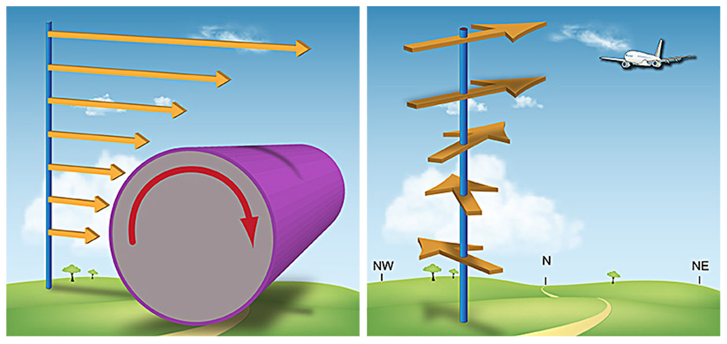
As stated, there are two main categories of low-level wind shear.
Speed shear (left-hand image) refers to significant changes in speed over a small distance, whereas directional shear (right-hand image) refers to rapid changes in wind direction in the lowest levels.
Both can be particularly dangerous on take off and landing as they apply unequal wind force across the aircraft. Additionally, strong head/tail winds can start and/or lose strength rapidly, quickly altering the aircraft’s approach path, and most importantly, can cause significant gains or losses in speed.
A TAF can describe significant wind shear in the lowest 1500ft above ground. This layer is critical as rapid variation in winds so close to the surface leave little room for maneuvering and reaction.
Left-hand image: Wind speeds increasing with height over a short distance, effectively "rolling" the air down toward ground (as more force is being applied to the top of the air mass than the bottom). This is a depiction of Speed Shear.
Right-hand image: Wind direction significantly changing with height over a small vertical extent, effectively changing the force on the place as it descends/ascends through the atmosphere. This is a depiction of Directional Shear.
Image Source: NWS (NWS JetStream - Thunderstorm Hazards: TornadoesOpen a new window)