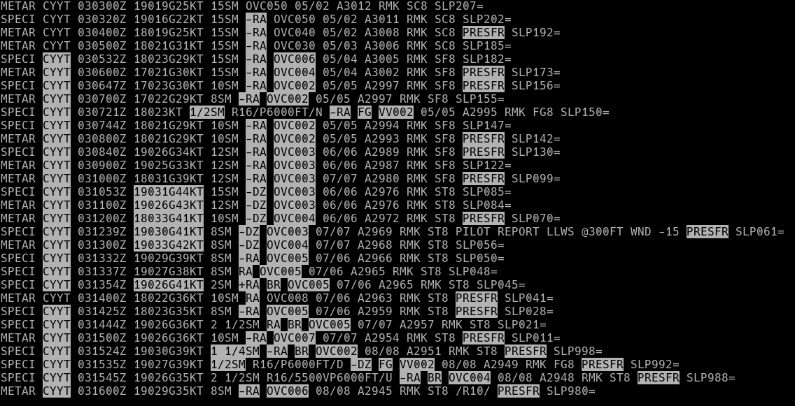
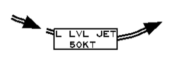
METAR Code
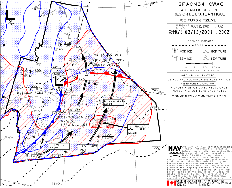
L LVL JET
Weather Symbol
A core of relatively high wind speeds, typically centered at altitudes ranging between 300 and 3000 feet above the ground, on occasion as high as 7000 feet.
Associated terms coming soon:
Inversion and low-pressure system are terms associated with a low-level jet that will be coming soon to the Aviation Meteorology Reference.
Low-level jet wind speeds usually range between 20 and 50 knots but can reach occasionally 100 knots or more and are typically found at the top of the boundary layer (the upper limit of the atmosphere which is most heavily influenced by being in contact with the earth’s surface). Although the vertical extent of the low-level jet ‘core’ is only a few hundred feet, the horizontal area covered by the jet varies extensively.
Low-level jets are important in meteorology, but especially in aviation meteorology because:
Image Source: Environment and Climate Change Canada
There are two primary mechanisms which can lead to the development of low-level jets:
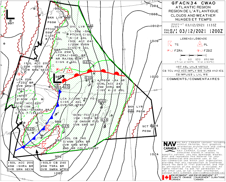
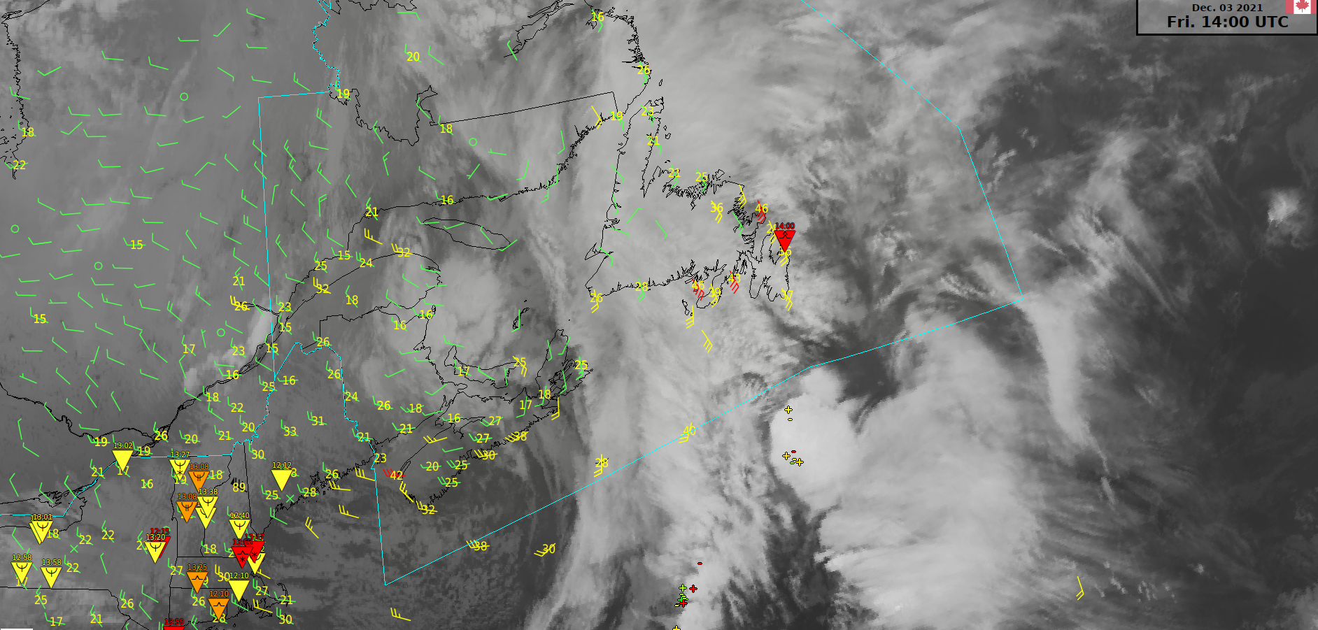
Example of typical pre-frontal low-level jet location. As the jet lies in the warm sector, it accelerates transport of warm, humid air from the south deeper into the warm sector, which in turn helps fuel convection along the fronts, extending their lifespan.
Image Source: Environment and Climate Change Canada
While the two mechanisms outlined above are main processes by which low-level jets develop, other factors can affect the strength/location of a low-level jet:
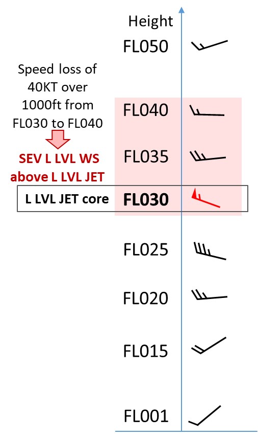
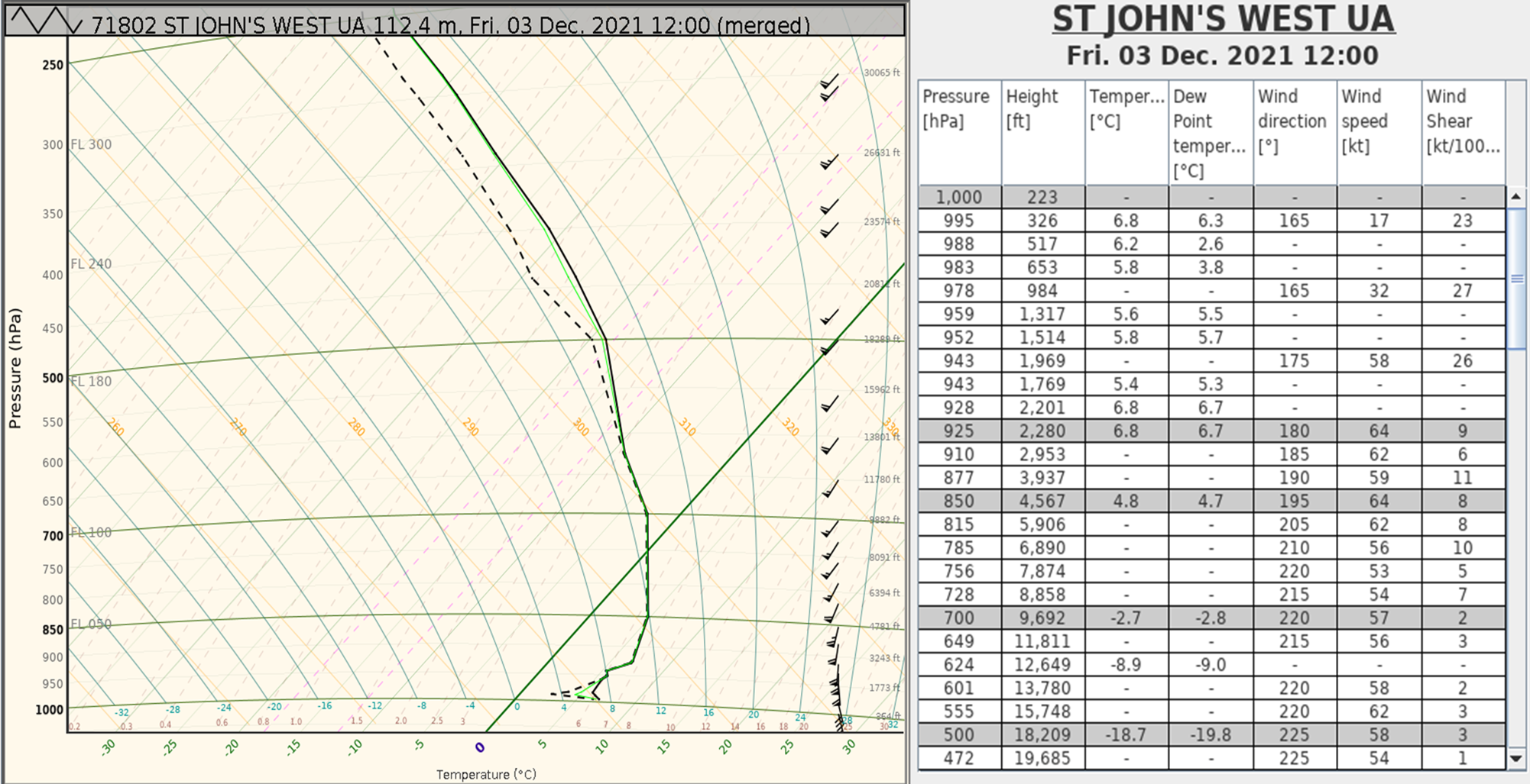
Here is an example of speed differences in the low levels, surrounding the jet that can lead to severe low-level wind shear due to a low-level jet.
Image Source: Environment and Climate Change Canada