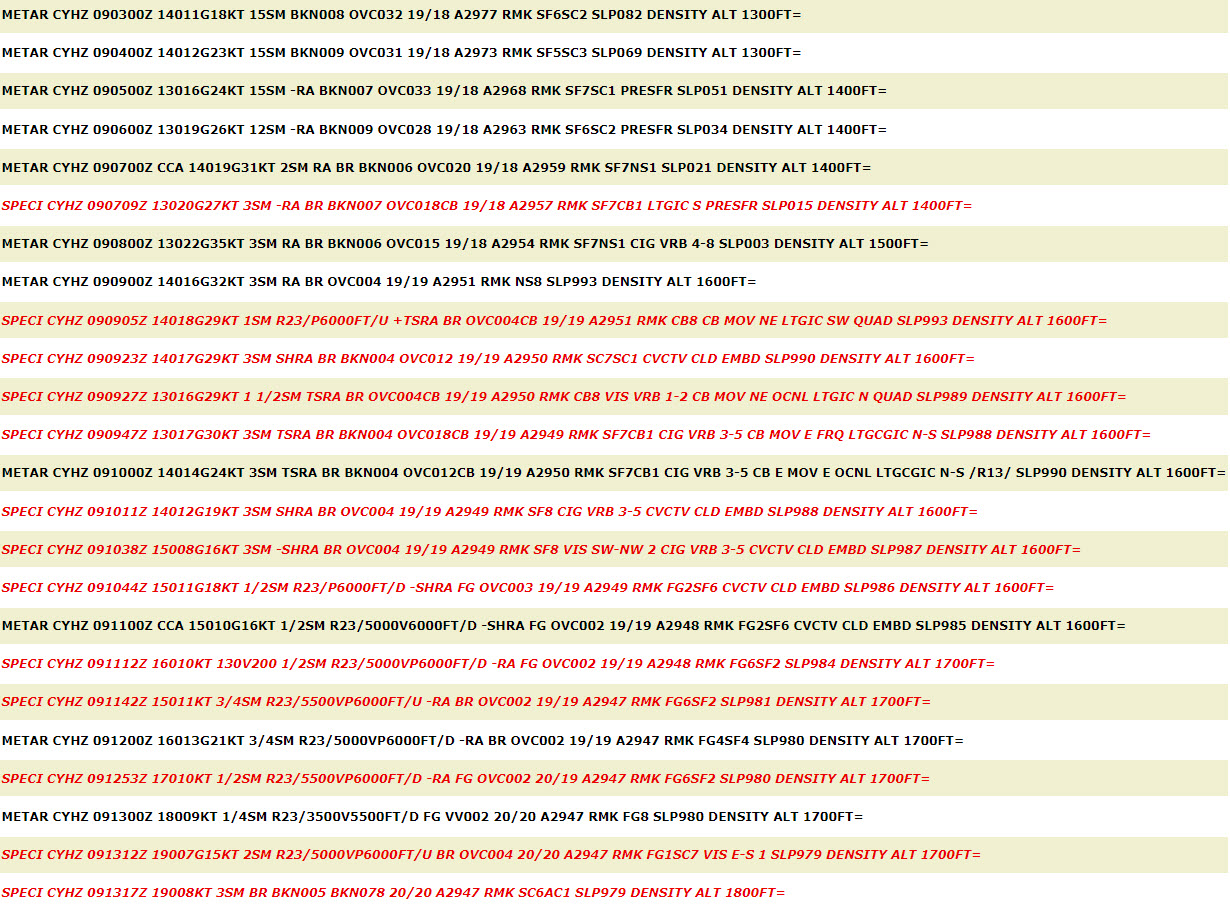
METAR Code
-RA/RA/+RA or -SHRA/SHRA/+SHRA
Weather Symbol
Rain and associated mist can act to reduce visibility and cause pooling in regions with no drainage. High rainfall rates, often associated with convection, can cause flooding, and rapid ice melts.
MANOBS: Precipitation of liquid particles, either in the form of drops or larger diameter than 0.5mm, or of smaller widely scattered drops.
Associated terms coming soon:
Dewpoint, lake effect, low-pressure system, orographic lift, and upslope flow are all terms associated with rain that will be coming soon to the Aviation Meteorology Reference.
For large scale regions of precipitation to form, a sufficient amount of moisture must be lifted and cooled to form clouds, in which precipitation can form. As with snow, there are two general types of precipitation: stratiform and convective.
Generally speaking, stratiform precipitation forms in synoptic scale systems (low-pressure systems and troughs) or in upslope flow. Lows and troughs are broad areas of upward vertical motion which causes air to lift, expand, cool and condense. At Canada’s latitude, the main process to form precipitation in low-pressure systems requires a mixture of water droplets and ice crystals in-cloud. This leads to snowflakes forming, which fall into warm temperatures and melt into raindrops.
Upslope flow is another mechanism that causes upward motion that is generally more rapid, but shallower, dropping precipitation at the top of (significant) terrain.
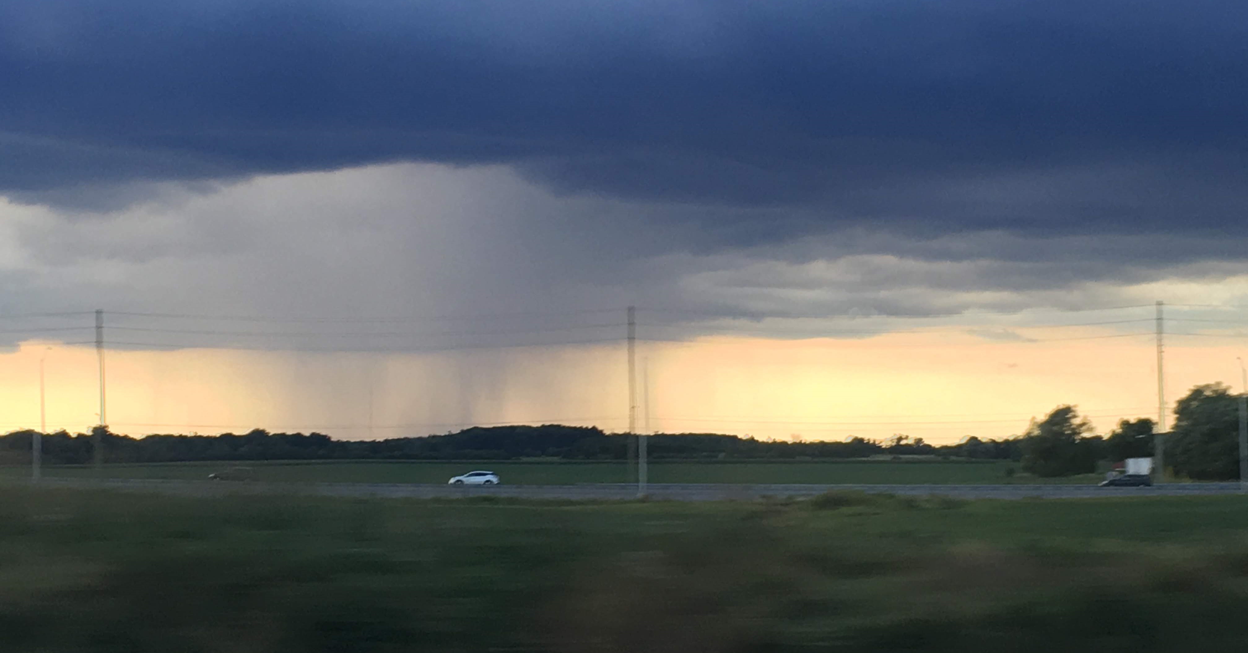
Lastly, convective clouds (TCU, ACC, CB) can produce rain showers, as shown in this image of a rain shaft associated with convective clouds. These shorter duration events can give light to heavy rainfall rates and rapid drops in visibility, depending on the level of instability and moisture available.
Image Source: Jessica Howell, MSC
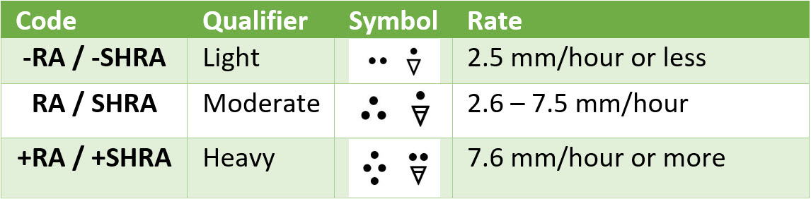
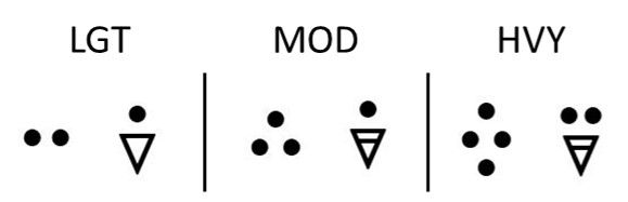
Rainfall rates are defined as shown in this table of rain intensity rate descriptors as defined in MANOBS 6.6.2.5.2. When the necessary ingredients come together, there are a few other factors that can impact a rain forecast, primarily the environment into which it is falling.
In stratiform situations, often associated with a low-pressure system, rain will often be heaviest near fronts or the low-pressure centre, where upward motion is maximized. Powerful upward motion is also the reason why upslope flow (eg. on the windward side of mountain ranges) often results in very high precipitation accumulations.
It is important to note, though, that the amount of rainfall is dependent on how much moisture is available in-cloud to fall, and having a continuous source of moisture. Low-pressure systems able to pick up more moisture (by passing over water or along a coastline for example), will have more water available to precipitate out than those passing over dry, inland regions.
Highest rainfall rates are often associated with embedded convection within the system, or along the cold front. Organized regions of convective clouds (TCU, ACC) can generate light to heavy rainfall, depending on the moisture available in the environment.
Reduction to visibility in rainfall is often caused in part by mist caused as rain evaporates into the air around it. While rain or rain showers alone can reduce visibility, light and moderate rain are generally not able to reduce visibility significantly without the presence of mist (MANOBS 6.6.2.5.1 Note), whereas heavy rain can.
The environment that the rain falls into is equally important to determining rainfall accumulation and visibility. When rain falls into an air mass, it is affected by the dryness/humidity of that air mass. When rain falls into an already relatively humid air mass, some evaporation of raindrops will occur in the low levels, but most rain drops will make it to the ground.
“Virga” is observed when rain falls into a layer of dry air below the cloud, in which the rain partially or completely evaporates before reaching the surface. Depending on how dry and deep the air is, it is possible that no rain would be reported on the ground, or the intensity may be much lighter at the surface than what would be experienced closer to the cloud.
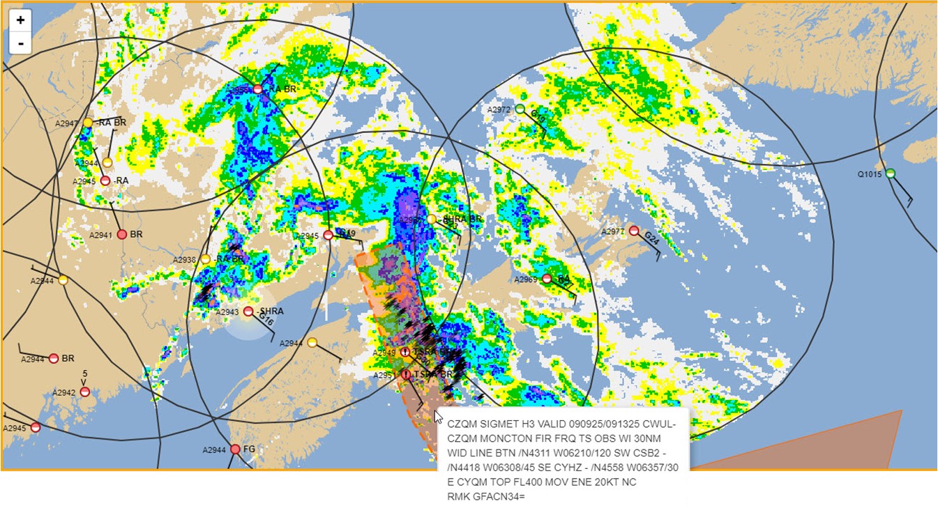
However, since rain is occurring high above ground, radar is still able to detect precipitation. This can be misleading to users, as it gives the appearance of (often) broad regions of rain approaching, while nothing is reported on the ground.
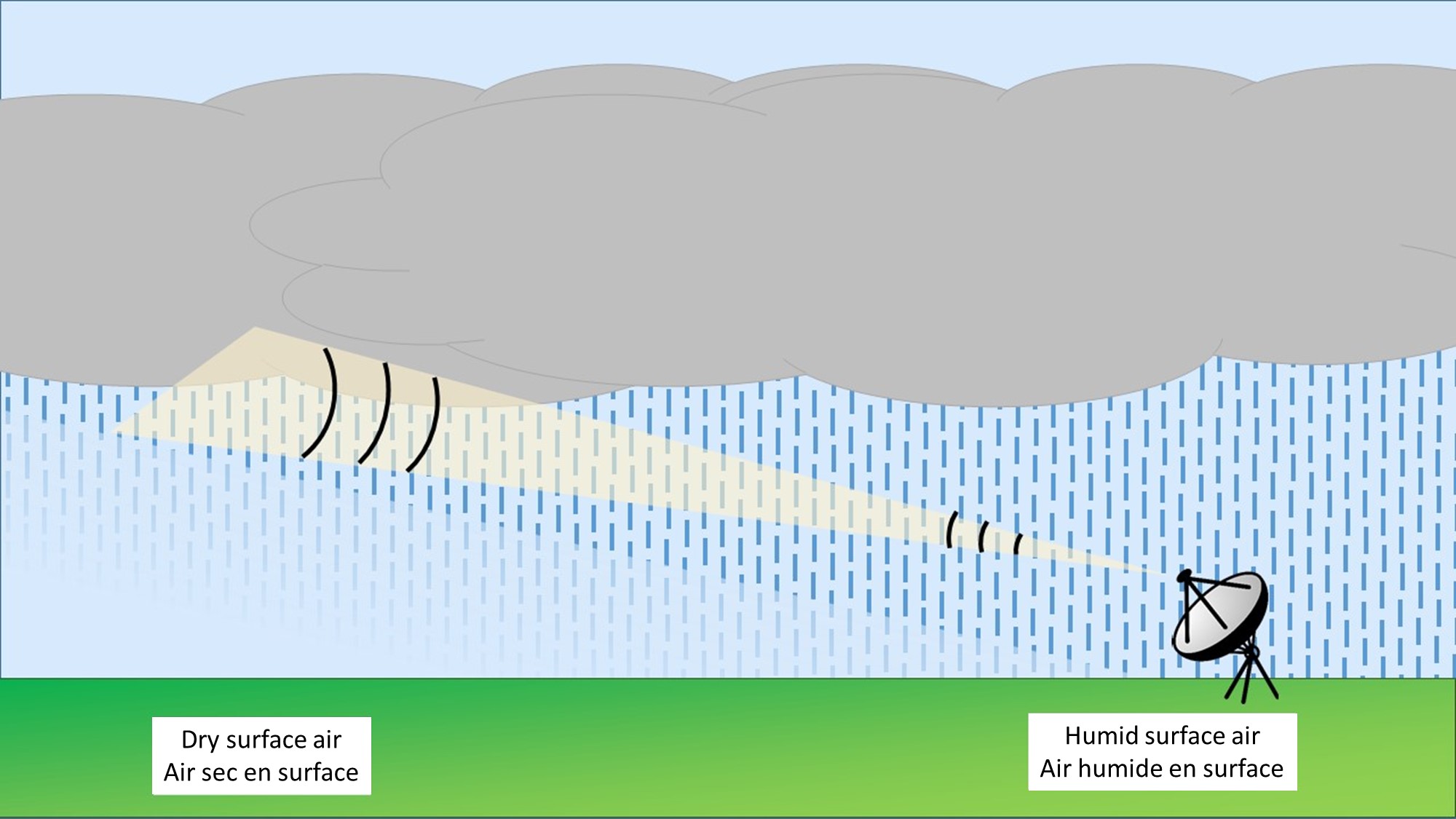
This is a depiction of virga as well as rain reaching the surface. On the left, rain falls into an extremely dry layer at the surface and evaporates before contacting the ground, whereas on the right, the rain falls into a more humid surface layer and makes contact with the ground.
Image Source: Environment and Climate Change Canada