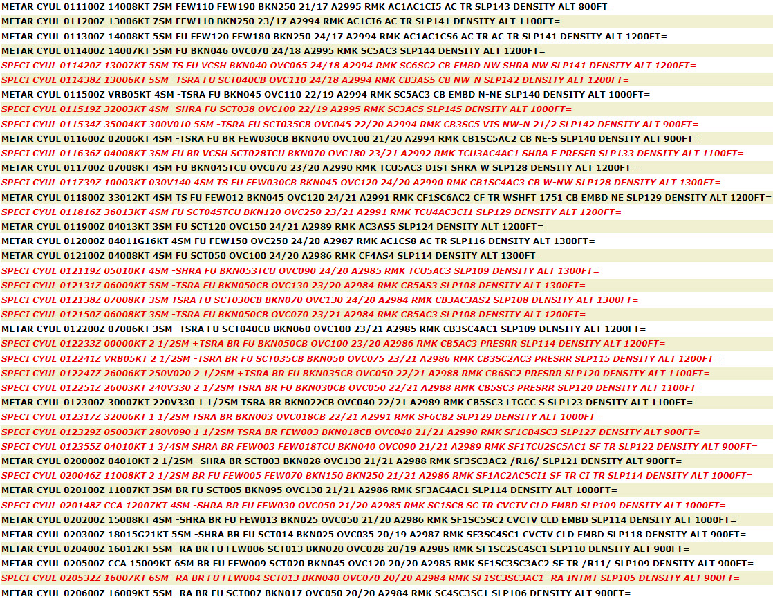
METAR Code
N/A
Weather Symbol
Atmospheric stability is a measure of the atmosphere that determines whether air will rise (unstable), sink (stable) or remain in a neutral state (neutral).
Associated terms coming soon:
Dewpoint, inversion, lake breeze, low-pressure system, mesoscale, orographic lift, tornado, and upslope flow are all terms associated with atmospheric instability that will be coming soon to the Aviation Meteorology Reference.
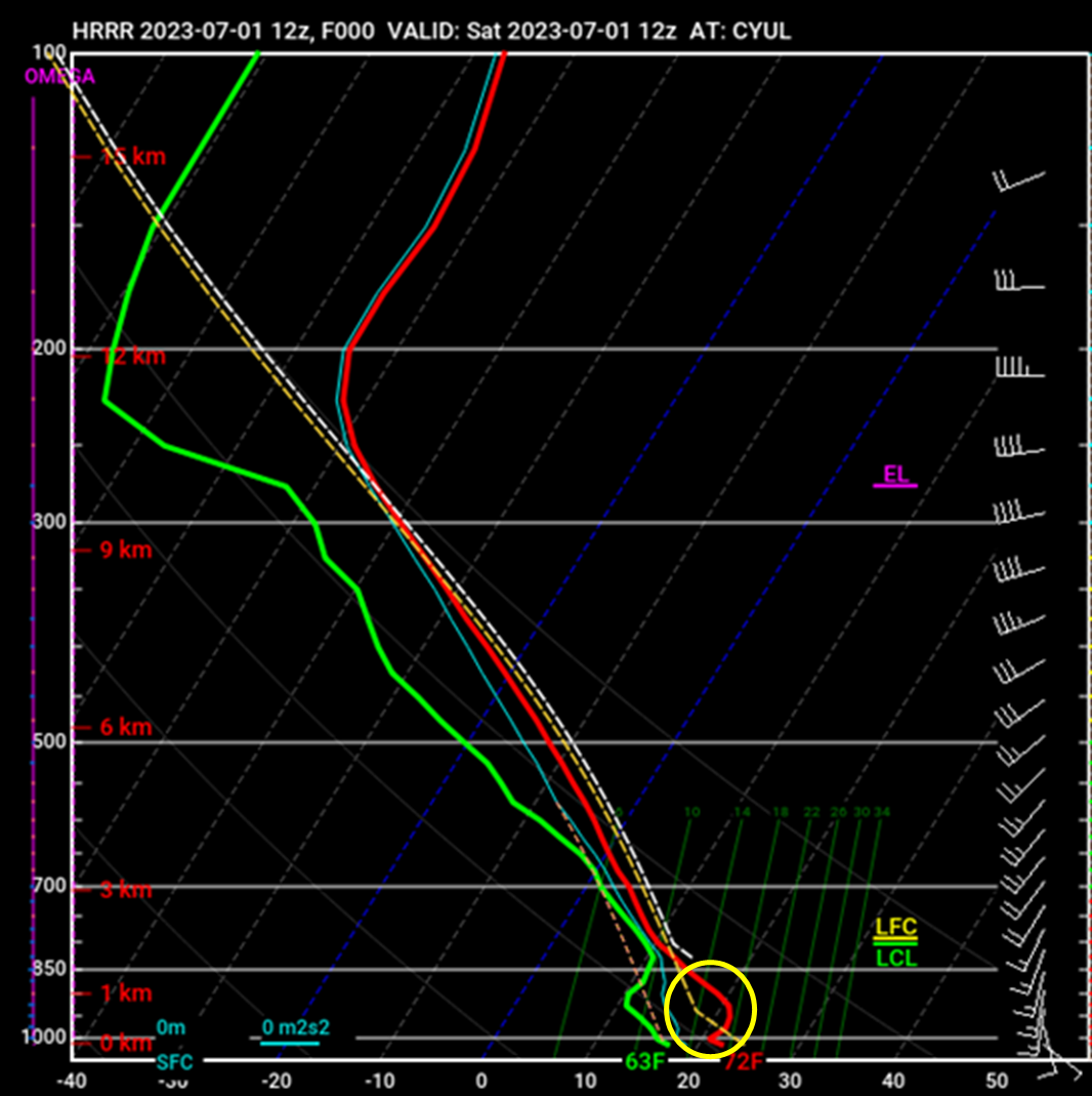
In meteorology, the atmosphere is often described as “stable” or “unstable”. The degree to which the atmosphere is stable/unstable determines most of the weather phenomena experienced both at the surface and in the upper levels of the atmosphere. Stability is assessed in the atmosphere by looking at how temperature and humidity change with altitude.
In the atmosphere, air that is warmer and more humid (i.e. less dense) than its surroundings will have the tendency to rise until it reaches surroundings of similar density. Air that is cooler and dryer (i.e. denser) than its surroundings, on the other hand, will tend to sink.
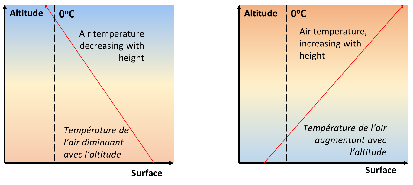
The graph on the left is a depiction of an unstable atmosphere, where temperature decreases with height. On the right, the graph depicts a stable atmosphere, where temperature increases with height. A section of the atmosphere where temperature decreases with height (denser air over less dense air, left-hand side graph) is considered unstable, whereas an atmosphere where temperature increases with height is considered stable (less dense air over denser air, right-hand side graph).
Importantly, the atmosphere is never entirely stable or unstable, but made up of several stable and unstable layers, meaning different kinds of vertical motion can occur at different heights.
Image source: Environment and Climate Change Canada
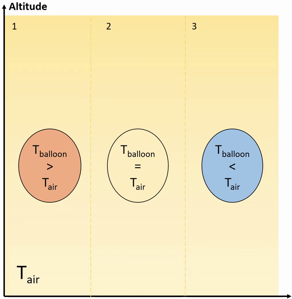
A layer will become more stable as the air parcel becomes colder and drier than the surrounding air. This GIF is an example of a stable, neutral and unstable equilibrium using a balloon, which can be applied to the atmosphere as well. In example 1, the temperature of the parcel of air is warmer than the air surrounding it. It will rise until it reaches air that is equal to or warmer than it. In example 2, the parcel of air is considered “neutral” and doesn’t move. It is the same temperature as the surrounding air. In example 3, the parcel of air is colder than the air surrounding it and sinks.
Stable Atmosphere
A stable atmosphere deters or inhibits vertical motion, that is to say it is an atmosphere where air “sinks” or remains at the “same level” or neutral. A stable layer at the surface (usually referred to as an inversion) often means calm winds and clear skies but can also trap smoke and pollutants in the low levels and prevent them from being dispersed into the upper atmosphere. When humidity is high, this stability can trap moisture near the surface and promote the formation of fog and drizzle.
Unstable Atmosphere
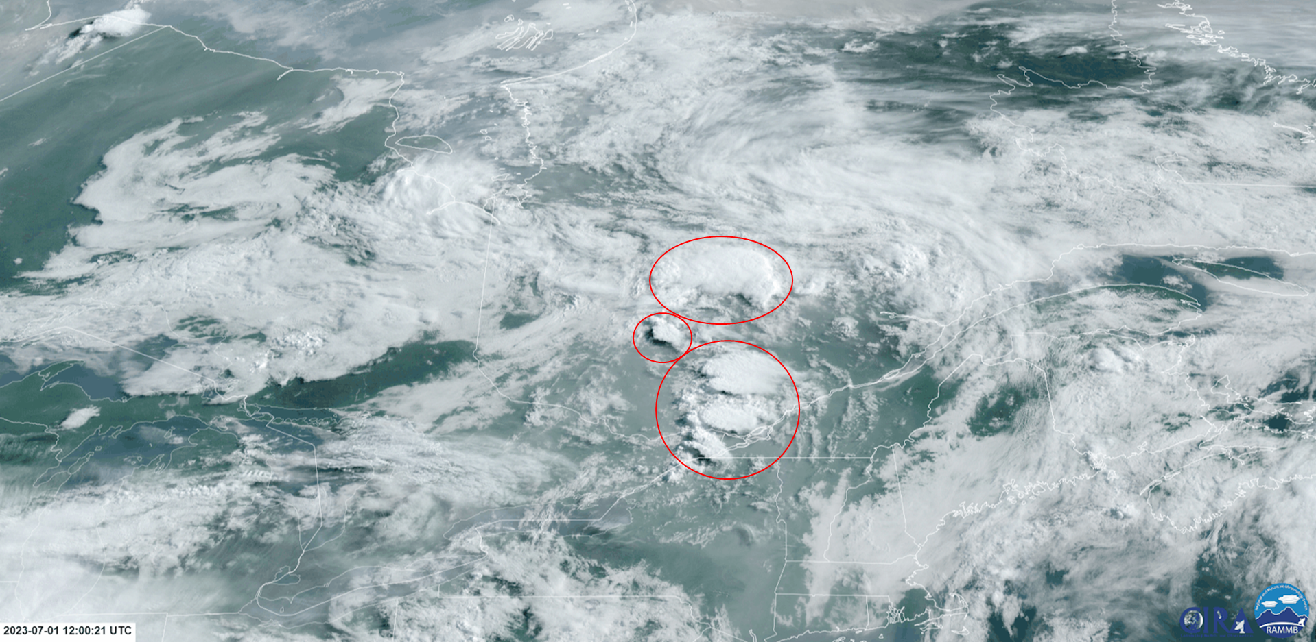
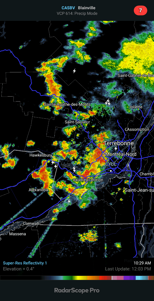
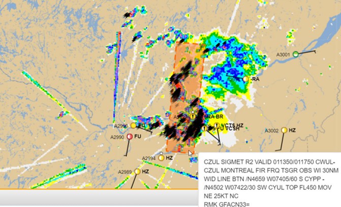
An unstable atmosphere is one that leads to air rising, the formation of convective clouds, precipitation and turbulence. It implies that air in lower levels becomes warmer than the surrounding air, and begins to freely rise. In general, an atmosphere where temperature decreases with height is considered unstable.
Instability will intensify by increasing the temperature or humidity (or both) of the air parcel, with respect to surrounding air.
Image source: Environment and Climate Change Canada