METAR Code
SNSQ
Weather Symbol
Abrupt change in visibility due to moderate to heavy snowfall. Possible blowing snow which would reduce visibilities even further. Snow accumulation may be significant depending on the duration of the event.
An intense, but usually limited duration period of moderate to heavy snow showers, accompanied by strong, gusty surface winds, and occasionally lightning.
Associated terms coming soon:
Dewpoint, lake effect, low-pressure system, and mesoscale are all terms associated with snow squalls that will be coming soon to the Aviation Meteorology Reference.
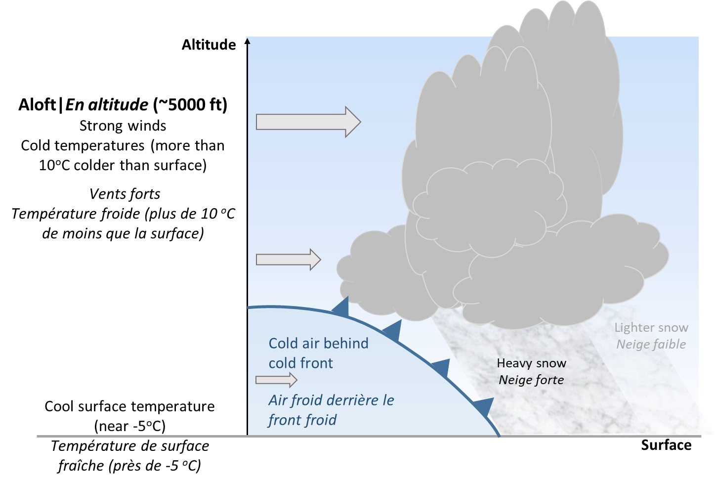
This image is a vertical cross section of a frontal snow squall. Cold front advancing and triggering convection along the front. A strong decrease in temperature with height makes for an unstable atmosphere and a perfect environment for strong convective snow, which is triggered by the cold front. Strong winds aloft are able to mix down to the surface and create strong gusts. Low surface temperatures are conducive to blowing snow. There are two types of snowsqualls to elaborate on: frontal snow squalls and lake effect snow squalls.
In order to generate strong snow squalls, a vigorous cold front or deep trough sweeping through the area, to act as a trigger for convection.
The front/trough also needs to enter into a region where there is a strong decrease in temperature from the surface to the mid levels (around 5000ft), where temperatures need to be less than about -15°C. This instability created by the contrast between the relatively warmer surface temperature and the cold temperatures in the mid levels provides an environment very conducive to strong convection that the cold front will help trigger, and help generate snow showers with very low visibility.
In order to reach “squall” criteria, winds aloft (near 5000ft) need to be very strong, such that they can be mixed down to the surface creating gusts near 40kt or more.
Lastly, for the highest impact, surface temperature colder than -5°C will allow for blowing snow, which will help reduce visibility even further, and close to 0SM in some cases.
Image Source: Environment and Climate Change Canada
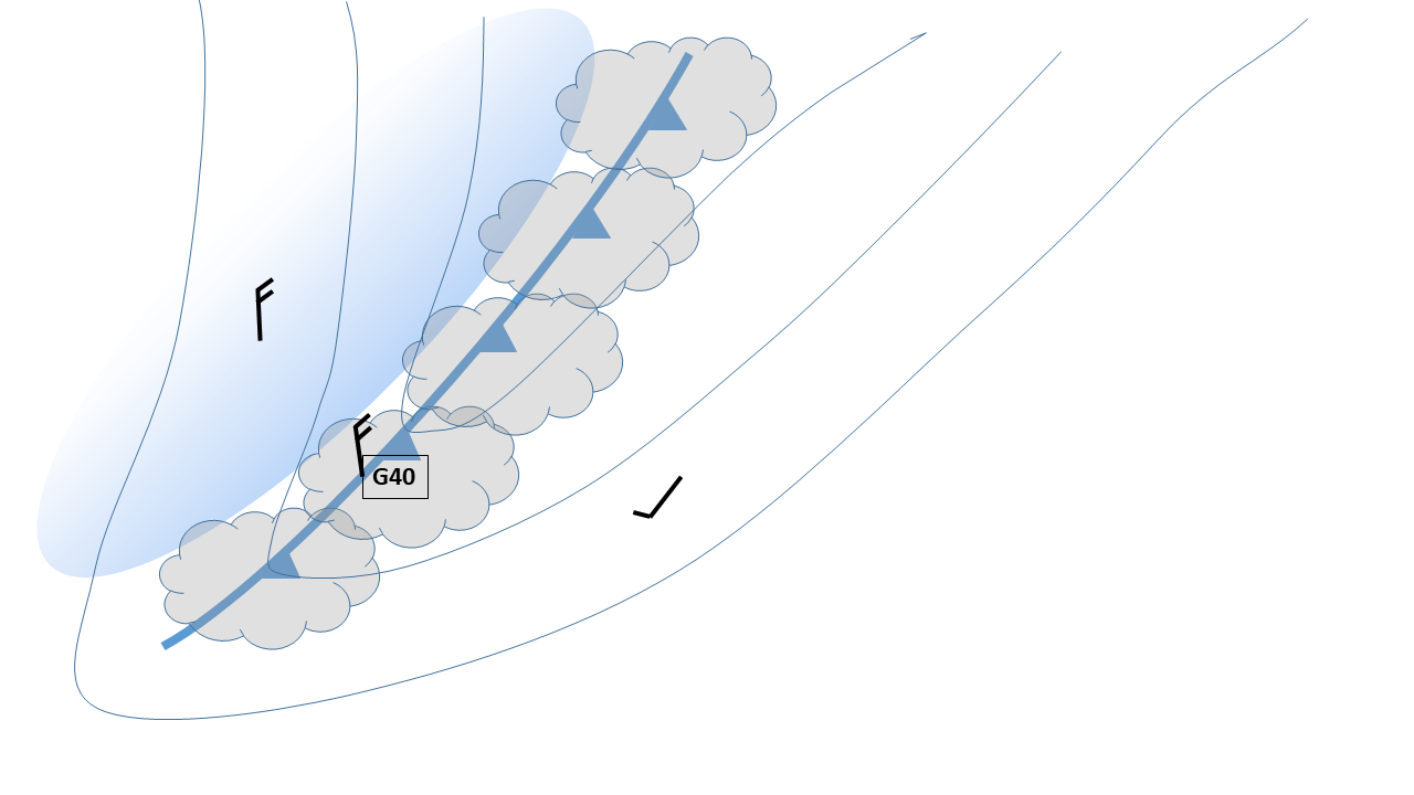
This image shows a simplified, top-down visualization of convective clouds formed along a strong cold front, and the location of strong wind gusts along the front.
Frontal snow squalls are generally associated with strong cold fronts or deep surface troughs. These trigger intense lift in an unstable environment, which kick-starts and supports a narrow line of convective moderate to heavy snow showers developing along the front (see Figure shown here). This line of convection becomes a frontal snow squall when the strong front/trough triggering significant convective snow showers is also combined with strong winds aloft, which can mix down to create surface gusts in excess of 40kt. Often the air behind a cold front remains unstable, and snow squalls can persist even after the passage of the cold front. Although these snow squalls are less organized, they still produce higher snowfall accumulations and a decrease in visibility.
Image Source: Environment and Climate Change Canada