METAR Code
N/A
Weather Symbol
An elongated area of relatively low pressure, extending from a low-pressure region. It is the opposite of a ridge. Troughs mark the locations of converging and rising air that is flowing from higher to lower pressure and are often associated with cloudiness and precipitation. A trough can be at the surface or aloft. If a trough develops at the surface on the leeward (sheltered) side of a mountain range, then it is called a lee trough.
A portion of this definition was taken from the Canada.ca Weather and Meteorology GlossaryOpen a new window
Associated terms coming soon:
Low-pressure system is a term associated with a trough that will be coming soon to the Aviation Meteorology Reference.
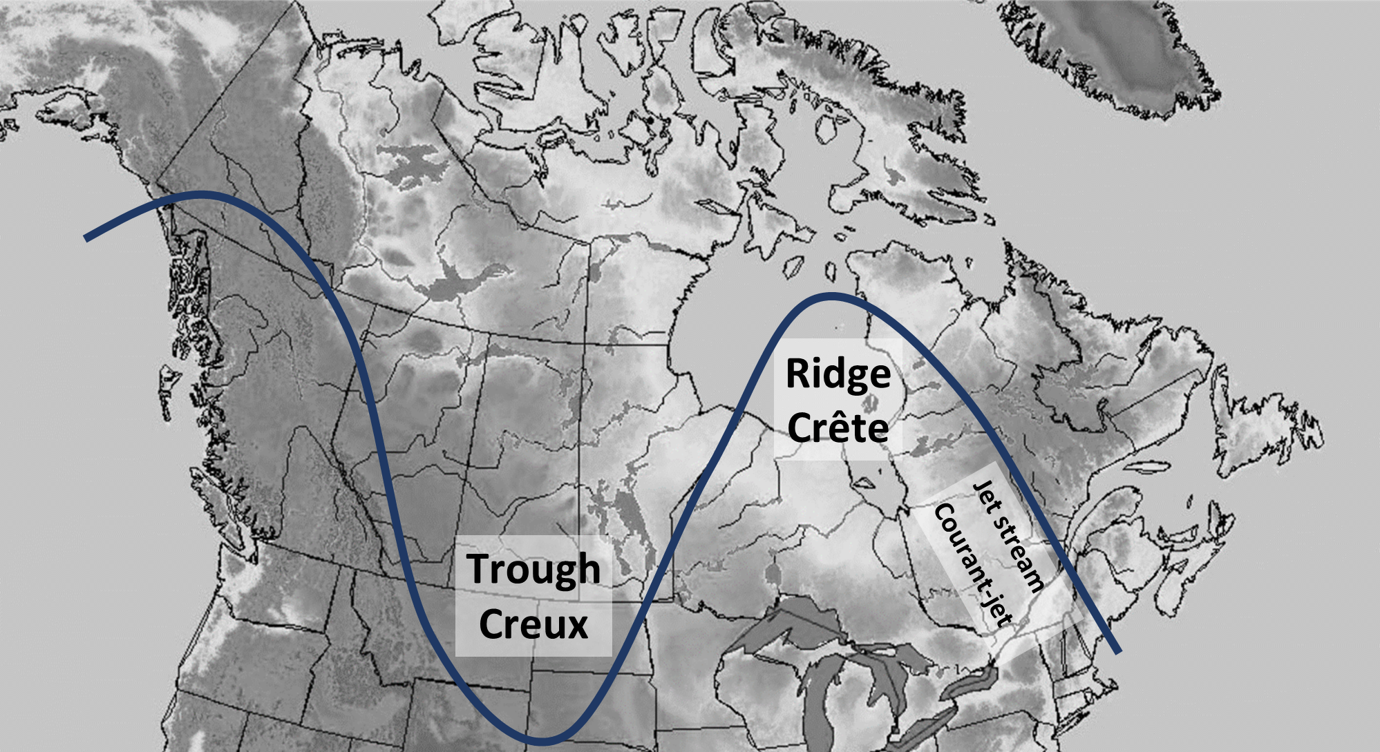
The differences in solar heating of Earth’s Polar Regions and the equator causes sharp boundaries in temperature which, when influenced by the rotation of the Earth, create currents of strong wind aloft called jet streams (ranging from 6-13km or 21000-42000ft above sea level). These jet streams circle the earth from west to east along the temperature boundaries. As the boundaries fluctuate, the jet stream will detour to the north and south, forming troughs and ridges. Sometimes the circulation near the base of a trough will detach from the main jet stream, forming a closed low-pressure center (closed isobars) with winds flowing counterclockwise around it.
This image is an example of a ridge/trough system created by the jet stream. Troughs tend to dip southward while ridges tend to extend toward the north.
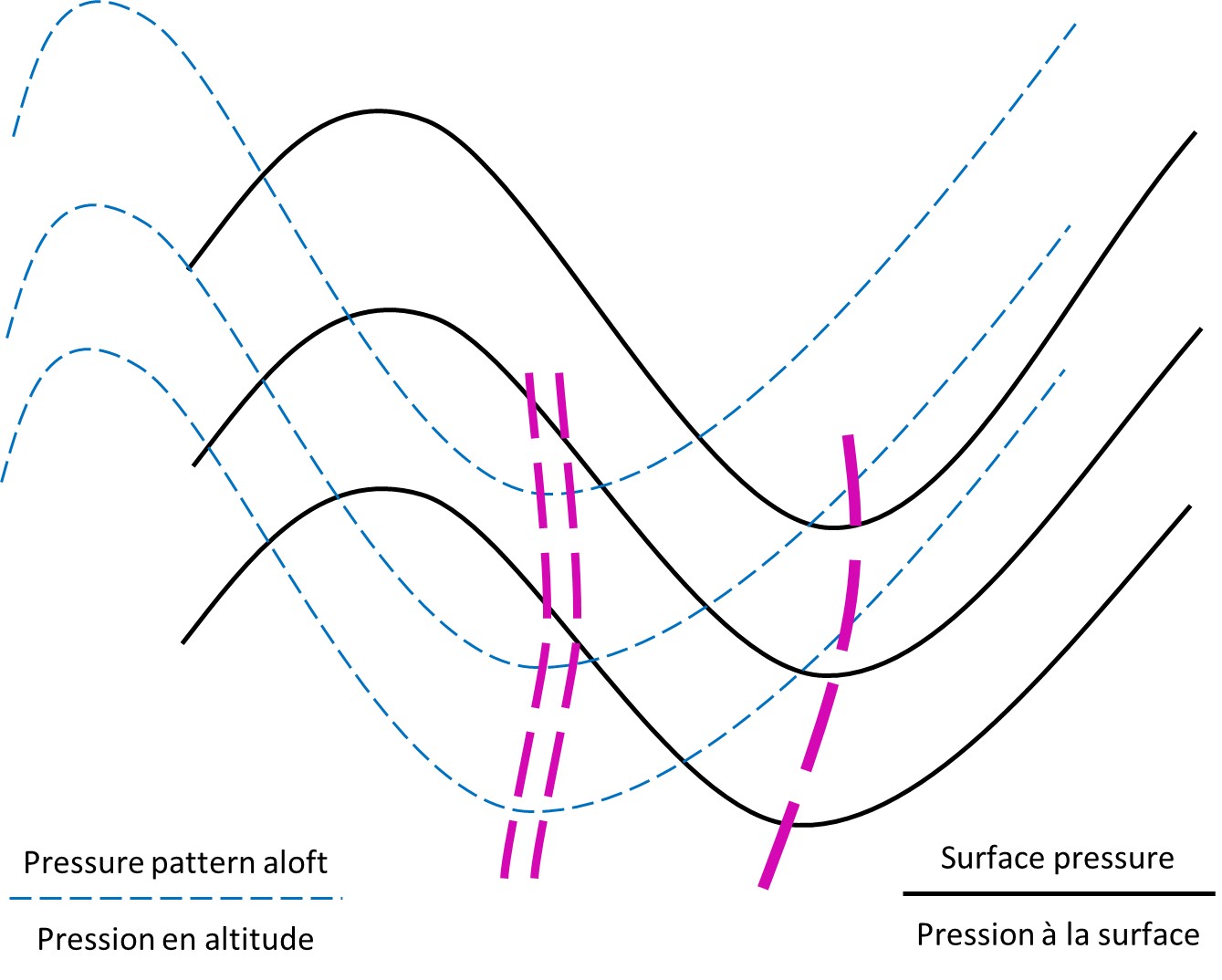
Troughs that form along a jet stream are associated with colder air that has been advected southward from more polar regions. This destabilizes the atmosphere along the trough by triggering warmer air at lower levels to rise in response to the change in temperature gradient, leading to the formation of a trough or an area of lower pressure at the surface.
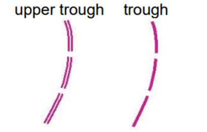
Troughs can exist at altitude (referred to as an upper trough) or on the surface, but produce many of the same effects in both locations. A surface trough (or a surface low-pressure system) is strongest when it is supported by an upper trough, as this ensures upward motion deep through the atmospheric column. Surface troughs differ from cold fronts (who often appear in sharp trough patterns on weather maps) in that they do not bring significant changes in temperature, which are characteristic of cold fronts.
Image Source: Environment and Climate Change Canada
As a trough moves above a surface, the leading edge is associated with decreasing atmospheric stability, upward motion, and a tightening pressure gradient, which leads to unsettled weather including precipitation, convective storms, and strong winds. As a trough passes, the weather will improve as stability increases in response to warming air aloft, descending air and rising pressure in its wake, and a slackening of the pressure gradient.
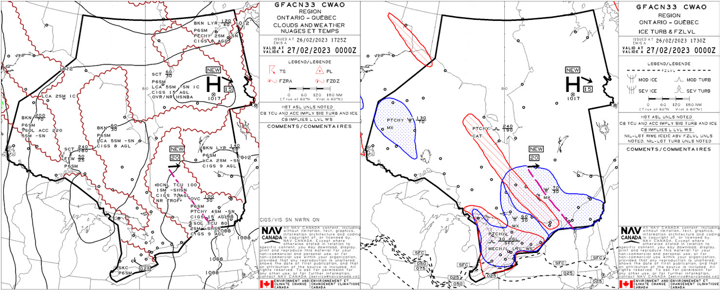
The nature of a trough and its surrounding air mass will determine the types and intensities of the weather features found within the trough. Troughs are often associated with frontal systems that will generate a wide variety of aviation weather hazards depending on the time of year and the intensity of the system. If moisture is low and air is warm within the air mass into which a trough is moving, the resulting dry and windy conditions may elevate fire risk. If moisture is plentiful, the lifting along the trough can cause thunderstorm development or heavy precipitation.
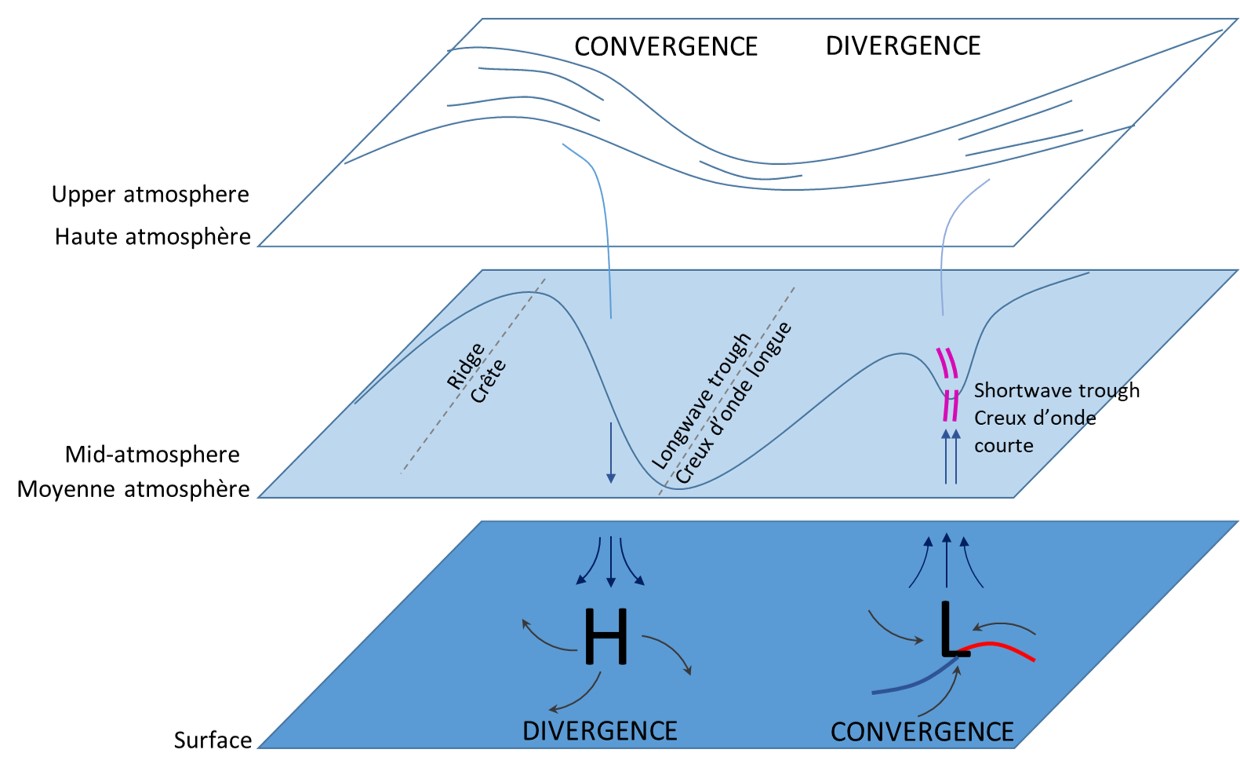
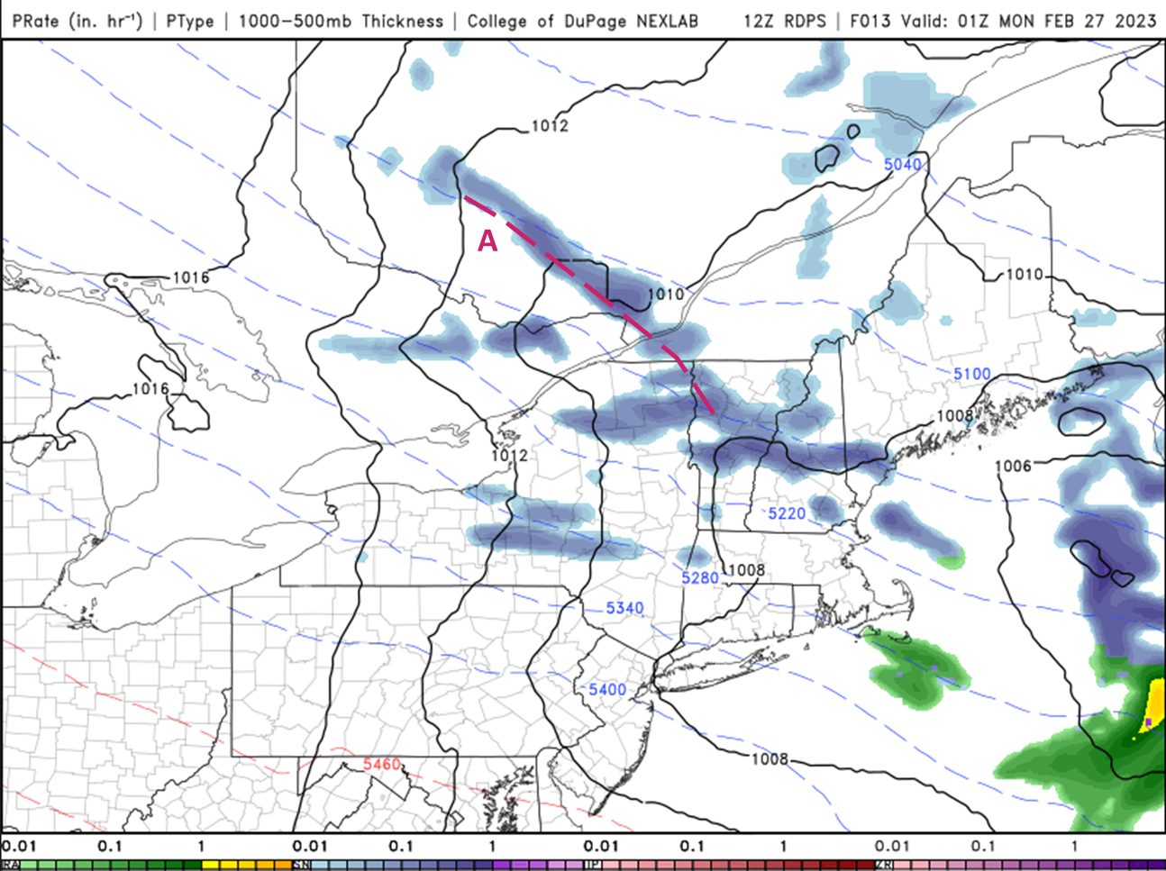
This image is an example of a surface frontal that is supported by both a longwave trough at altitude, as well as a shortwave/upper trough aloft, which amplifies surface convergence and divergence aloft, supporting development.
While surface and upper troughs exist at different heights in the atmosphere, they offer most of the same characteristics at both levels. They are responsible for enhanced lift as well as a marked change in wind speed and direction. Because of this, the surface trough acts mainly on altering conditions as they exist on the surface, causing lift from below. However, an upper trough, while it can enhance surface features, causes lift in the mid-atmosphere as well, generating convection and clouds/precipitation based higher in the atmosphere.
Image Source: Environment and Climate Change Canada
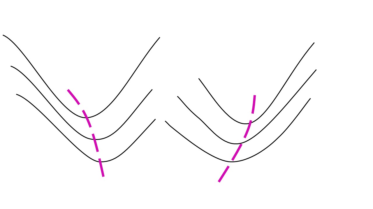
The direction of tilt of a trough can influence the location of strongest winds and give a clue about its evolution and severity. A negatively tilted trough, whose axis tilts to the northwest with increasing latitude (left-hand trough in image), is usually strengthening and accelerating and is the most likely to bring deep instability and severe weather. It is also associated with increasing winds to the west of the trough as it passes overhead due to the transport of angular momentum. A positively tilted trough (right-hand trough in image), whose axis tilts to the northeast with increasing latitude, is usually weakening and decelerating, though the slower movement can cause heavy rain and flooding in humid environments and freezing rain events in the winter due to a prolonged area of warm moist air overriding the cold surface.
Image Source: Environment and Climate Change Canada
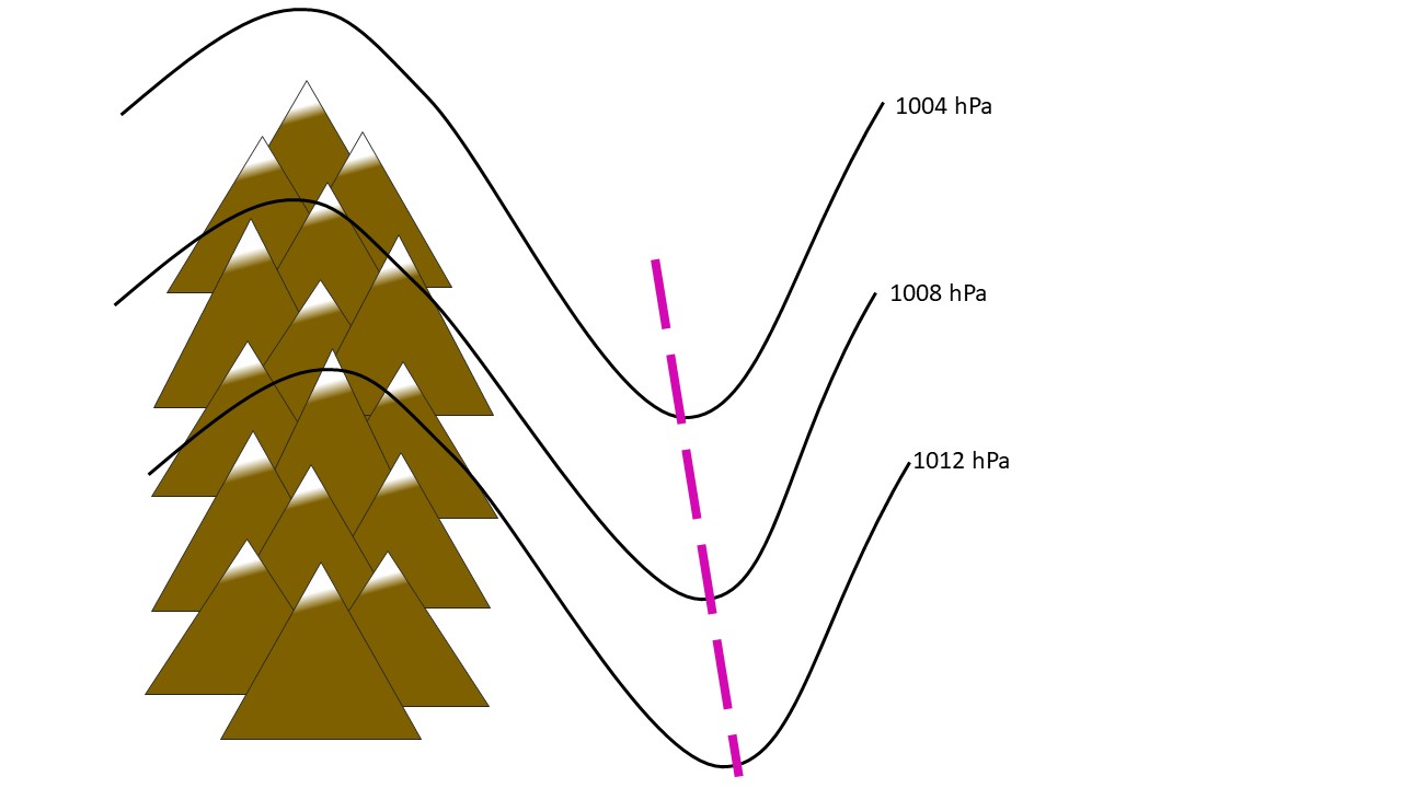
A lee trough is the name given to a surface trough that develops in the leeward (sheltered) side of a mountain range. This image is an example of such a surface pressure pattern reflecting a lee trough on the leeward side of the mountains (such as the Rocky Mountains). As air flows over a mountain, the side of the mountain perpendicular to the flow experiences increasing pressure from the push of air against it. In response, an area of relatively lower pressure forms on the opposite side of the mountain, where downslope-flowing air warms as it descends. This phenomenon occurs frequently along the eastern slopes of the Rocky Mountains in Alberta, where the resulting lee trough can dictate the strength and direction of the surface winds in Calgary.
Image Source: Environment and Climate Change Canada