METAR Code
N/A
Weather Symbol

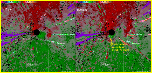
With the strong winds they produce, microbursts can produce a lot of damage over a relatively small area and in a short amount of time. Microbursts can produce wind damage comparable to that of a tornado, which is why they can also be rated on the EF-Scale. As they are capable of producing winds in excess of 160km/h, they are capable of uprooting trees, damaging infrastructure that is not well secured, and could even flip over smaller aircrafts.
The sudden change in wind speed and direction that a microburst produces is particularly hazardous, as it can cause sudden, severe turbulence.
Associated terms coming soon:
Low-pressure system and mesoscale are terms associated with microbursts that will be coming soon to the Aviation Meteorology Reference.
A microburst is a localized, powerful column of sinking air (downdraft/downburst) within a thunderstorm that is usually less than or equal to 4 km in diameter, which lasts for less than 5 minutes. With wind speeds that can exceed 160km/h, microbursts can cause extensive damage at the surface and pose a serious hazard to structures and aircraft.
Firstly, microbursts are meteorological phenomena associated with thunderstorms therefore, the main ingredients necessary for thunderstorm development must be present in order for a microburst to develop; moisture, instability, a trigger as well as wind shear are all essential for thunderstorm, and hence microburst, development.
There are certain features that forecasters look for in the environmental profiles that can promote the development of microbursts within thunderstorms. Any factor that increases the strength of the downdraft of a thunderstorm will enhance the potential for microburst formation. Some of those factors that forecasters look for in atmospheric profiles include:
Dry air aloft – Since dry air is more dense than humid air, it descends more easily than the moist air around it. So, as dry air mixes into a thunderstorm, it can enhance/accelerate the downdraft of the thunderstorm.
Strong winds within the dry mid-level layers – these stronger winds aloft create wind shear, which can also enhance the downdraft of a thunderstorm.
Cold air aloft – Similar to dry/moist air, colder air is more dense than warm air. When there is cold air aloft that can feed into the downdraft, the cold air can fall much more readily, and enhance the downward acceleration of the downdraft
Evaporative cooling – as raindrops within a thunderstorm reach the dry air aloft, some of them will evaporate. This evaporation causes the air to cool, which can contribute to the downward acceleration of the downdraft.
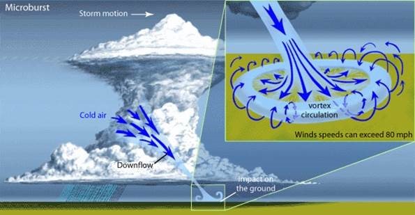
This is a diagram of a thunderstorm as well as the location of the microburst. The microburst occurs in the downdraft region of the thunderstorm. As the cold air descends rapidly towards the surface, it then spreads in all directions creating turbulence and extreme wind shear.
Image Source: NOAA
A process known as "downbursting" creates microbursts. Downbursts (also called downdrafts on a less intense scale) occur when a thunderstorm produces a column of cold air that is much denser than the surrounding air. This much higher density causes the column of air to descend rapidly towards the ground due to its greater weight, accelerating as it goes.
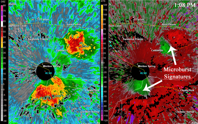
As the descending column of air reaches the ground, it spreads rapidly out in all directions. This spreading out of air at the surface is what defines a microburst. The strong outflow winds can be particularly dangerous because they can cause sudden changes in wind speed and direction.
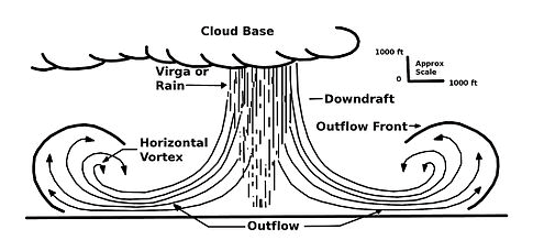
This image is a zoomed in picture of the downdraft/downburst area of a thunderstorm. As the column of air descends rapidly towards the ground, it spreads out in all directions creating a rapid change in wind speed and direction.
There are two primary types of microbursts: wet microbursts and dry microbursts.
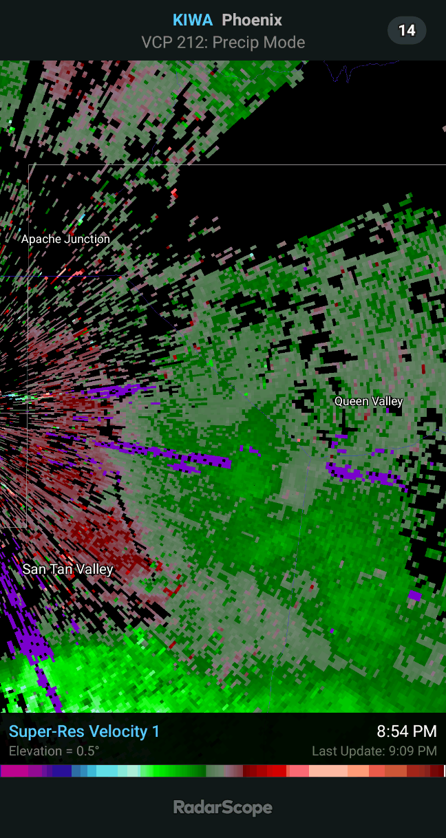
Wet microbursts are a type of microburst that involves a sudden and powerful downdraft of cool air from a thunderstorm which is accompanied by the presence of rain in the downdraft. As the downdraft that hits the ground and spreads out horizontally in a radial pattern. Wet microbursts can be spotted visually, as the precipitation falls rapidly compared to the rain around it.
Dry microbursts, on the other hand, do not contain precipitation. As the downdraft develops, the raindrops evaporate as the air descends to the surface resulting in a cloud-free column of air. Dry microbursts cannot be spotted visually unless their surface winds pick up dust or other particulate matter at the ground, since they are not associated with precipitation.
Image Source: WikipediaOpen a new window