METAR Code
VCTS
Weather Symbol

A thunderstorm in the vicinity of an aerodrome carries the same hazards as a thunderstorm (such as hail, strong downdrafts, and lightning), without necessarily impacting the terminal itself.
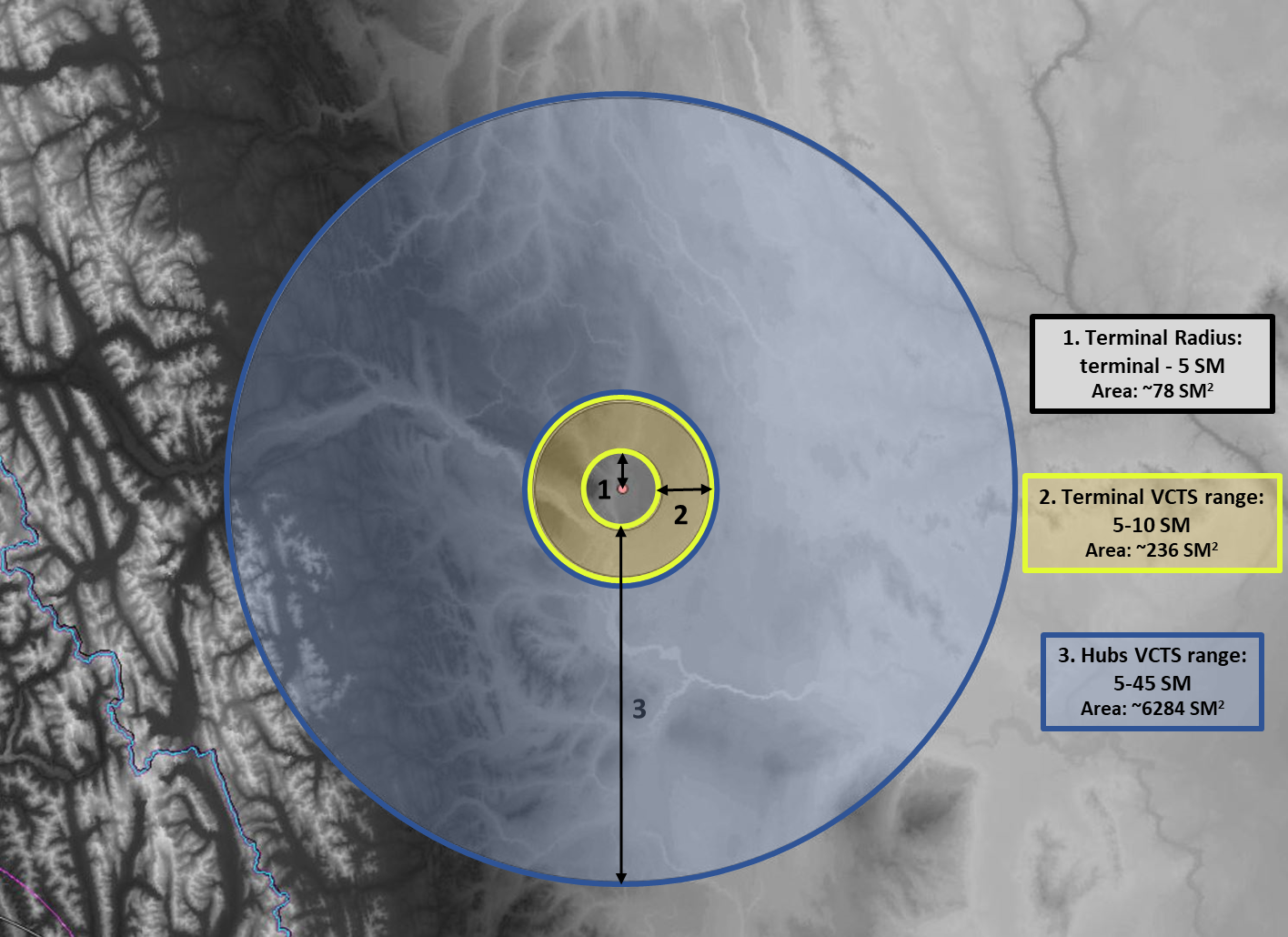
VCTS is a term used in TAFs to describe thunderstorm situations where there is high regional confidence of occurrence of thunderstorms but a corresponding low probability at the aerodrome itself. For regional sites, VCTS refers to thunderstorms that will occur more than 5SM away from the terminal but within a 10SM radius. At hub airports where the terminal area covers a larger region, the term VCTS must also cover a larger region, being outside of 5SM but within 45SM.
On a given day where forecasters have assessed that thunderstorm activity will occur, describing the spatial extent of the risk is a priority. While forecasters have many ways to describe thunderstorm occurrence in the TAF, the MSC adopted the use of VCTS in order to elaborate further on the confidence level of thunderstorm occurrence at the terminal.
There are often situations where forecasters are very confident that thunderstorms will occur but will not happen within the 5SM radius of the terminal. PROB30, PROB40 and TEMPO groups all speak directly to the probability of thunderstorms at the terminal directly, which occasionally forced forecasters to use PROB30s to describe thunderstorm activity that was likely to occur close but not at the terminal itself.
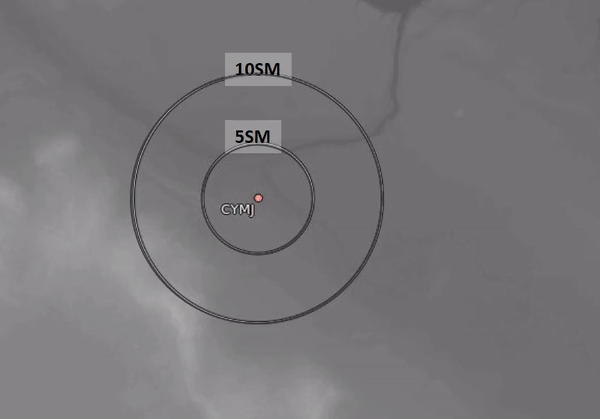
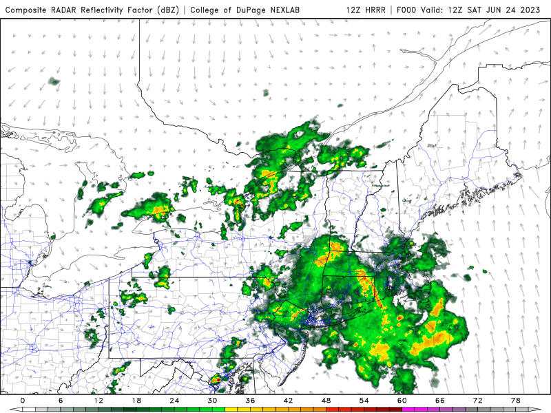
This GIF is an example of VCTS at Moosejaw, SK. Lightning strikes are recorded within 10NM of the airport itself, but not within 5NM. At this distance, the thunderstorm would not be recorded as “TSRA” at the airport, so putting TSRA in TEMPO is an overstatement of what the forecaster may believe will happen at the terminal. “VCTS” is useful in this case, as the forecaster can specify that thunderstorms will pass close by, but not impact the terminal directly.
Image source: Environment and Climate Change Canada
VCTS functions as an indicator that forecasters are confident in thunderstorm development close to but not at the terminal. Close thunderstorms still pose a risk to the airport themselves but can be regarded as a “PROB20” at the airport, with higher confidence that they will occur outside of the 5SM radius around the airport that the TAF describes. It is worth noting that VCTS covers any report of TS but does not cover a METAR/SPECI report of TSRA.
For most airports, VCTS describes thunderstorms happening between 5-10SM (4-9NM) from the terminal and is generally reserved for single cell, less organized thunderstorms.
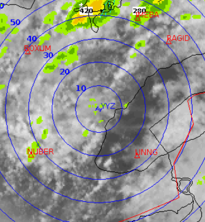
In situations where the terminal area covers a large region, such as the four Canadian major airports (CYYZ, CYVR, CYUL and CYYC), VCTS can be used to describe organized thunderstorms occurring and/or expected to affect areas of importance (e.g. approaches, departures, terminal area entry fixes, etc.) within the terminal area (45SM/40NM radius) but not the aerodrome itself.
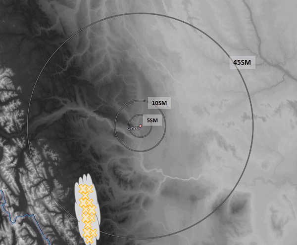
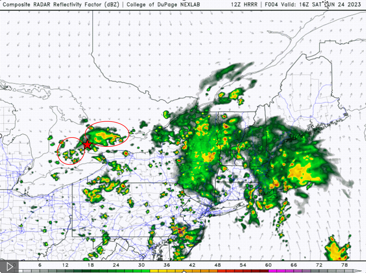
This GIF is an example of VCTS at a hub site. Since the terminal area covers a much larger area, traffic is affected by convection at much larger distances from the airport itself. VCTS covers the 5-45SM radius disk surrounding hub airports.
Image source: Environment and Climate Change Canada