METAR Code
N/A
Weather Symbol
Squall lines, like thunderstorms can cause many hazardous impacts including:
A narrow, but long line (up to hundreds of kilometers long) of severe thunderstorms that typically form along or ahead of a cold front.
Associated terms coming soon:
Dewpoint, low-pressure system, and tornado are all terms associated with squall lines that will be coming soon to the Aviation Meteorology Reference.
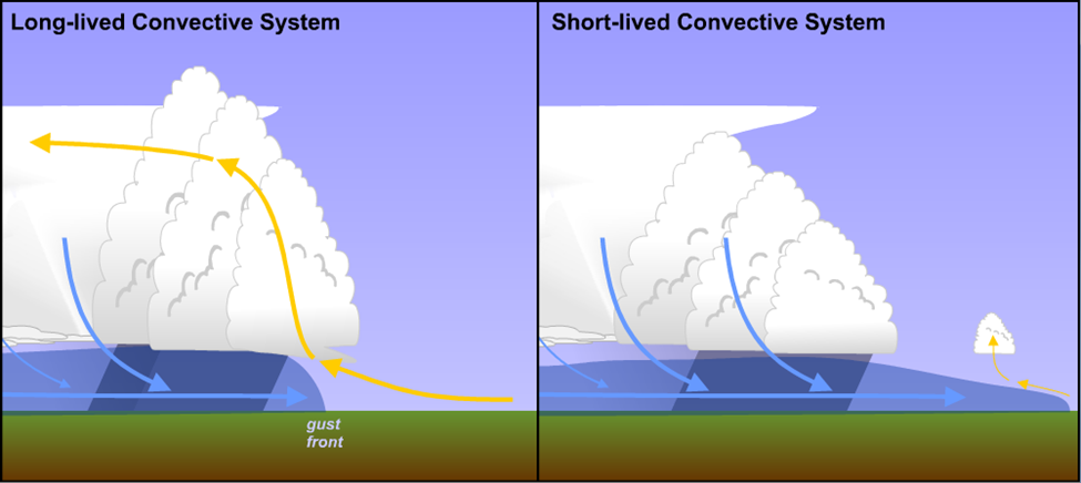
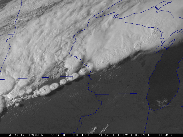
This image shows the idealized evolution of thunderstorms into a squall line. On the left, individual thunderstorms begin to develop along a cold front. Initially these thunderstorms are discreet, but as they mature, they begin to merge together as shown on the right. Eventually, the thunderstorms merge completely and form one long line of thunderstorms, and are moved by the cold front.
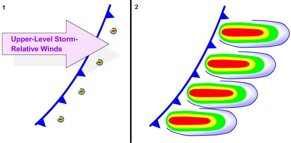
In general, squall lines require the same ingredients as thunderstorms for formation; a good supply of moisture, instability, and a trigger (most commonly a cold front). However, importantly, strong wind shear must also be present in order for squall lines to develop. Wind shear separates updrafts and downdrafts by rotating the cumulonimbus clouds, effectively enhancing their strength and lifespan, and supports development of new thunderstorm cells in the line.
As individual thunderstorms develop along the cold front, they quite often merge and evolve into a continuous line, at which point it is called a squall line. The squall line will be carried along with the front and produce heavy rain, gusty winds, icing, turbulence, and lightning strikes, among other hazards.
For a deeper dive on Squall Lines, this COMET module on Severe Summer WeatherOpen a new window, or this one on Severe Convection: Mesoscale Convective SystemsOpen a new window elaborate much further.
Image Source: Penn State Department of Meteorology and Atmospheric ScienceOpen a new window
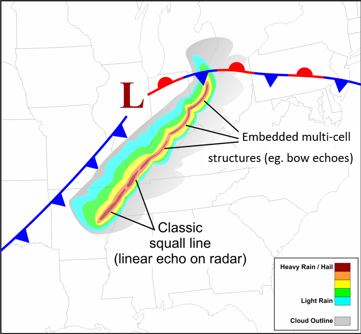
This is the typical location of a mature squall line as the individual thunderstorms merge to form one long line of thunderstorms.
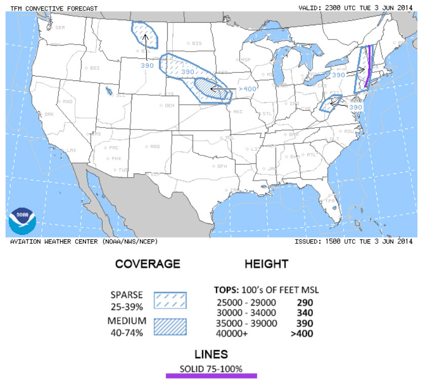
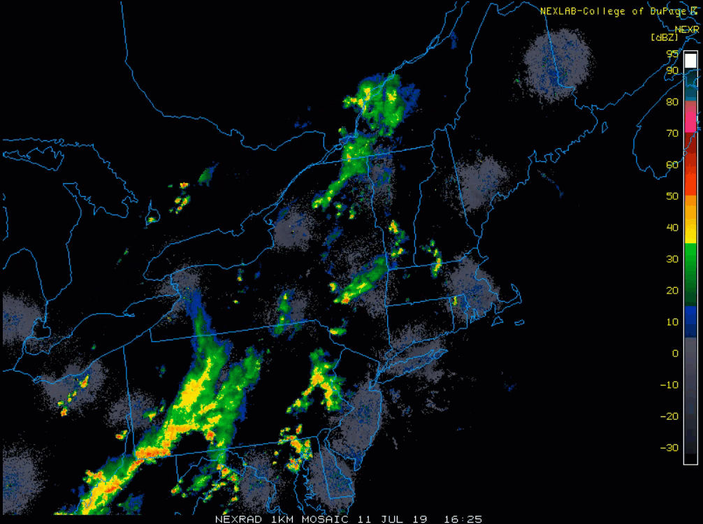
Squall lines are typically characterized as a narrow line of thunderstorms that can span hundreds of kilometers. These lines can appear straight, but often have several curved features embedded within them, giving them an irregular shape over their length. Differences in wind shear over the line are responsible for these curves and gives sections of the squall line the characteristic "bow echo" shape when viewed on radar.
At the leading edge of the squall line is a gust front, which is a boundary between the cool, downdraft air from the thunderstorms and the warmer, more stable air ahead of the storms. This boundary can produce strong, gusty winds at the surface, often in excess of 40-45KT.
Behind the gust front is the main body of the squall line, which consists of a series of thunderstorms in various stages of development. At the rear of the squall line is a region of cooler, drier air that has been further cooled by the downdrafts from the thunderstorms. This can lead to a sudden drop in temperature and humidity once the squall line has passed.
Image Source: Penn State Department of Meteorology and Atmospheric ScienceOpen a new window