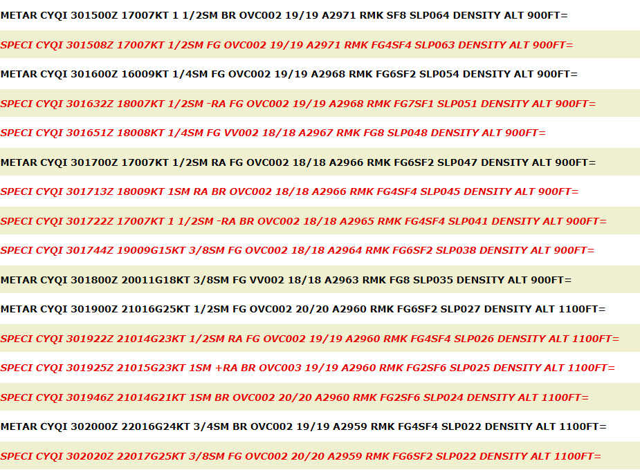
METAR Code
N/A
Weather Symbol
Onshore flow can be responsible for the lowering or generation of cloud ceilings, affecting surface temperature and humidity, and initiating convection.
Air being pushed from over waters onto land, often increasing onshore humidity.
Associated terms coming soon:
Lake breeze, lake effect, low-pressure system, and mesoscale are all terms associated with onshore flow that will be coming soon to the Aviation Meteorology Reference.
There are mainly two processes that can cause onshore winds to form.
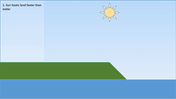
A sea (or lake) breeze circulation can develop. This is caused by a relatively cloudless day allowing for the ground to heat up much more significantly than the water beside it, allowing air to readily rise over the land. As air over land rises, air from the water is pulled in to replace it on shore, redirecting surface winds onshore from over the lake.
Alternatively, synoptic winds (such as ahead of a low-pressure system, or behind a high-pressure system) can be directed from water toward the land. When synoptically driven (caused by the overall pressure gradient), these winds can be stronger, and more long lasting.
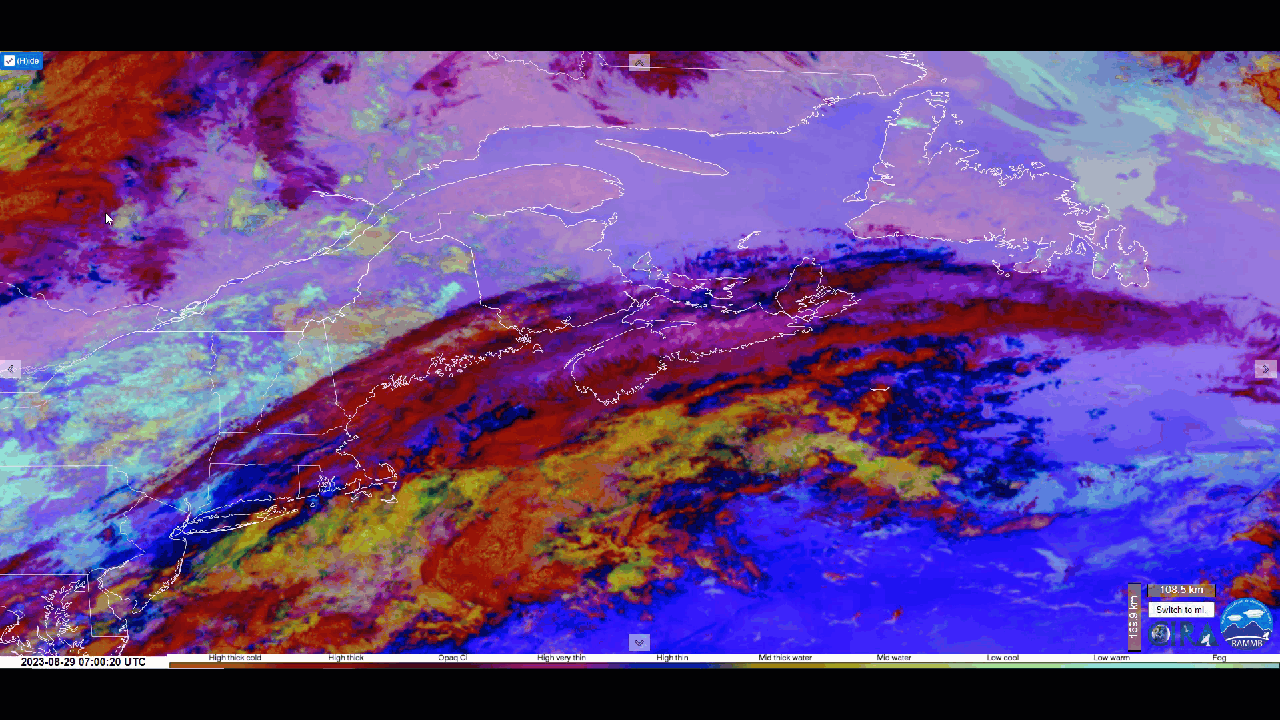
The concept of onshore flow is itself very simple, but it can have some marked impacts. The main impact of onshore flow is increasing humidity where wind from the water meets the shore. Depending on the time of day and atmospheric stability, this can cause different effects.
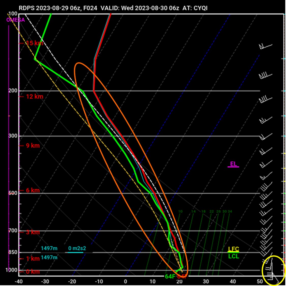
In situations where cool air from the water is moving over warmer land (often daytime, spring/summer/fall conditions), cool air is rapidly heated when it comes in contact with the ground, and is able to lift higher into the atmosphere, where it condenses, and forms clouds. This process, effectively a lake breeze circulation, can generate convection in onshore flow if clouds are able to freely rise high enough in the atmosphere. A similar process can occur when a cool air mass with a cloud deck moves over very warm land; if the ground is significantly warmer than the invading cloud-filled air mass, heat from below can force clouds upwards, improving cloud ceilings. This is generally only observed in summer with maximum surface heating.
This animation shows an idealized lake-breeze circulation developing, generating onshore flow and clouds inland, as well as potential convection if conditions are unstable enough.
Image Source: Environment and Climate Change Canada
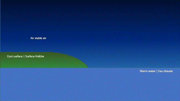
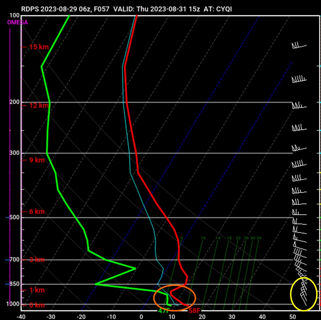
On the other hand, when cold air moves over cool or cold land, the opposite occurs. When onshore flow moves over a cooler surface, a surface inversion forms, creating a very stable layer which inhibits upward motion. As this cool, humid air moves over cold land, it is cooled from below, bringing the air closer to its dew point temperature. With sufficient cooling, mist or low clouds can develop near the surface, and continue to lower as long as humidity and cooling continue. This effect is often seen in coastal regions at or after sunset in onshore flow.
When a cool air mass filled with low clouds moves over a cold surface in stable conditions (often seen in winter, or at night in all seasons), the gradual increase in ground height causes slight cooling in the air mass as it is lifted. However as the layer is stable, the clouds cannot build upward, so they build down toward the surface instead, lowering cloud ceilings. As onshore winds continue to push onshore, ceilings can continue to fall, especially through the overnight period. In winter, in onshore flow conditions, this phenomenon can be responsible for maintaining low cloud ceilings in coastal regions through all hours of the day. This setup is particularly significant in the winter, as water, and the air directly in contact with the water are warmer than land temperatures, which can create or maintain very strong surface inversions all day long.
This animation is a simplified depiction of fog developing in warm onshore flow over a cool surface. Warm, humid air moving onshore raises the humidity, while the cool surface cools the air above it, both raising humidity and lowering temperature simultaneously, bringing the air rapidly closer to its dew point temperature until fog forms and spreads out onshore.
Image Source: Environment and Climate Change Canada
Moreover, when onshore flow encounters a barrier (e.g. moving directly onshore and up a significant hill or mountain slope; orographic lift), one of two things can happen depending on atmospheric stability:
This animation is a simplified depiction of clouds in onshore flow interacting with elevated topography in land. In unstable conditions, humid air or clouds can be pushed up into an unstable atmosphere where they can freely grow and become convective clouds. In stable conditions, clouds will only lift as high as the inversion height (here, the mountain top), and as the air mass cools at altitude, and additional humid air is lifted up the mountain face, cloud ceilings will build down toward the surface, potentially generating drizzle or rain.
Image Source: Environment and Climate Change Canada