METAR Code
N/A
Weather Symbol

A low-pressure system can become lake enhanced when it passes over a relatively warm, large, open body of water, which effectively adds moisture to the storm. This additional moisture increases the amount of precipitation that can fall from the low-pressure system.
Lake enhanced precipitation occurs on a smaller scale, when the effect of onshore flow from an open body of water injects additional moisture and lift into an already active region of precipitation, creating locally higher precipitation amounts on shore.
Associated terms coming soon:
Dewpoint, lake breeze, lake effect, and mesoscale are all terms associated with lake-enhanced precipitation that will be coming soon to the Aviation Meteorology Reference.
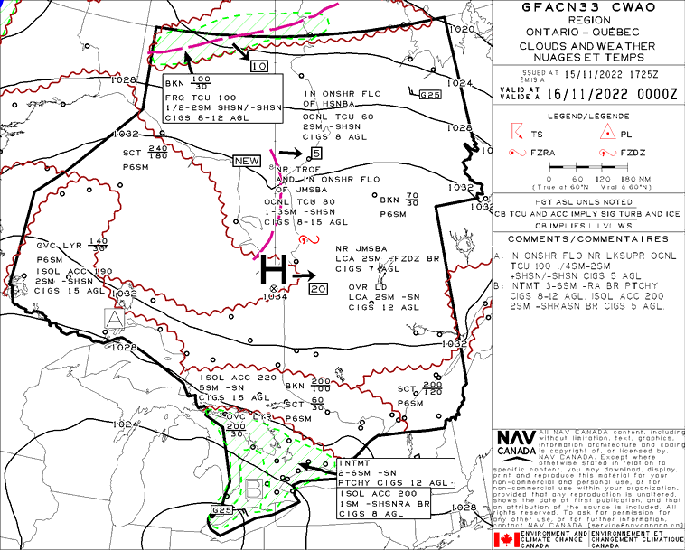
In order for a low-pressure system to become “lake-enhanced”, the low must be passing over a large source of relatively warm moisture, such as the Great Lakes, the Manitoba lakes, or another large and open body of water, and moving onshore.
The lake(s) must be mainly to entirely ice free and have a surface temperature that is warmer than the air around it. This will allow a significant amount of warm, humid air to rise from the water’s surface.
Similarly, lake enhanced precipitation requires an active low-pressure system to be passing over an open body of water, while surface winds below the system move onshore. Similar to lake effect snow, the lake-enhanced precipitation will form when onshore winds take warm, humid air from over the lake and brings it to shore.
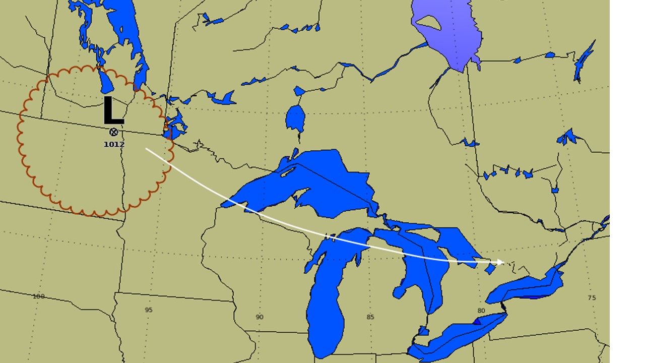
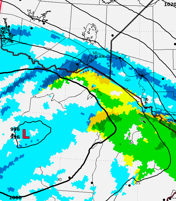
This is an example of a low-pressure system path (in white) that would allow for lake enhancement. The low-pressure system here (an Alberta Clipper) is moving towards the Great Lakes, which would be completely or mostly ice free.
Image Source: Environment and Climate Change Canada
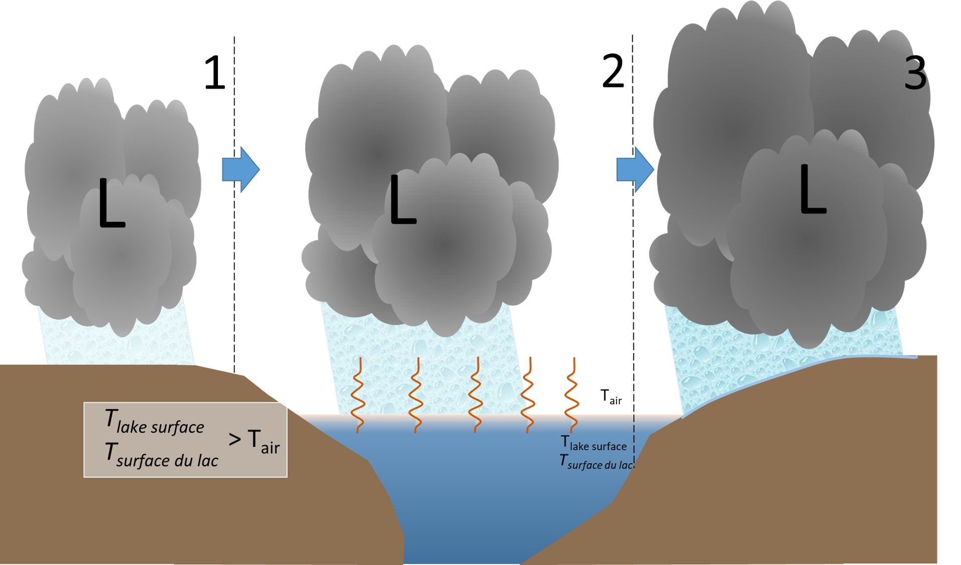
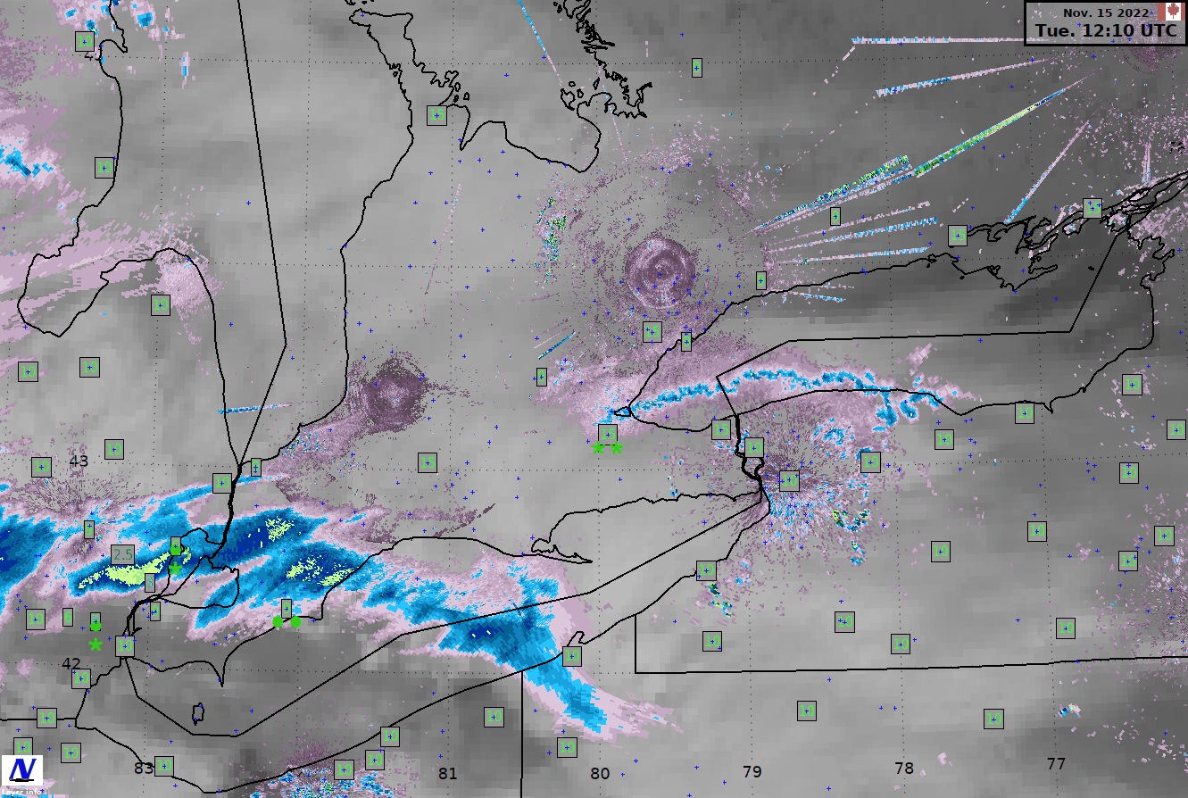
When the low moves from land to over the open, warm water source (Step 1), it is fueled from below by the water (Step 2). Since the temperature of the air is cooler than the water, the warm, humid air from the lake is able to rise, adding additional moisture and heat to the low-pressure system. This additional energy source prolongs the life of the low-pressure system and increases the amount of available moisture to turn into precipitation.
Not only does this additional “precipitation fuel” get taken in, but as the low and winds push onshore (Step 3) there is additional localized moisture thrust up into the lowest layers of the low-pressure system, further boosting precipitation. The onshore flow in combination with the low striking the shore results in locally higher precipitation rates at and inland of the downwind coast.
Similarly, lake enhanced precipitation only requires some level of onshore flow within the low-pressure system. Once this modified air passes over the lake and crashes into the shore, it will shoot up into the low-pressure system, rapidly generating additional precipitation to fall from the low-pressure system onshore.
Image Source: Environment and Climate Change Canada