METAR Code
N/A
Weather Symbol

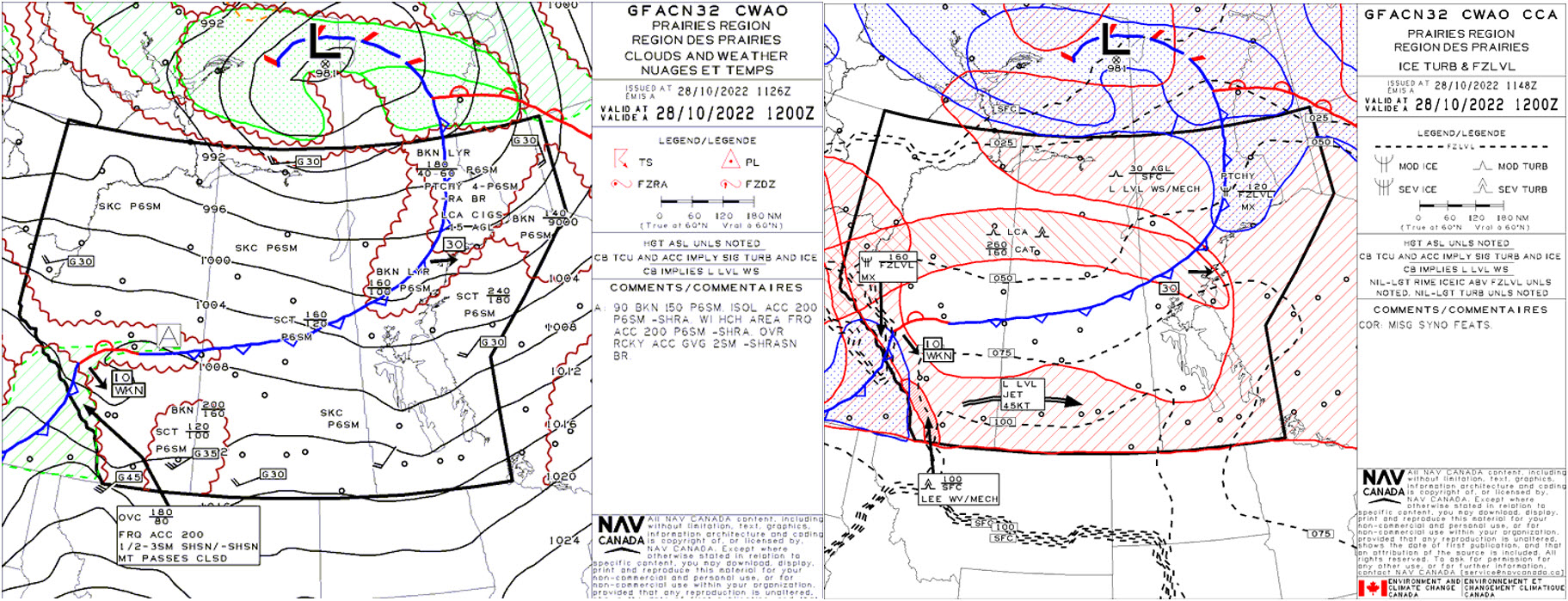
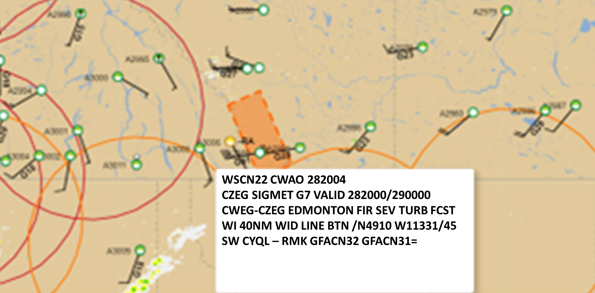
Lee waves are a type of mountain wave that are caused by a strong wind flow crossing over some type of barrier, such as a mountain range and constrained to a narrow depth of the atmosphere. Since the phenomena is directly related to the barrier, lee waves are stationary with respect to the barrier.
Associated terms coming soon:
An inversion is a term also associated with lee wave that will be coming soon to the Aviation Meteorology Reference.
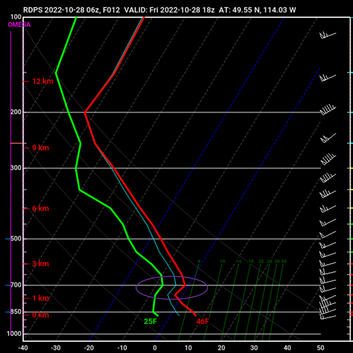
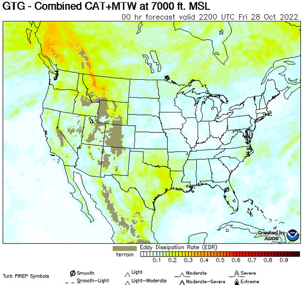
Lee waves occur when there is a strong wind flow across a barrier such as a mountain range. A stable air layer is essential for the development of lee waves. This stability is typically characterized by a strong temperature inversion, where the temperature increases with height instead of decreasing. When the wind reaches the barrier, it ascends over the barrier but is deflected downward to lower levels of the atmosphere downwind due to the stable layer. This inversion at or above mountain top is often referred to as a “critical layer”, which enables amplification of the mountain waves in the layers between the mountaintop and the critical layer.
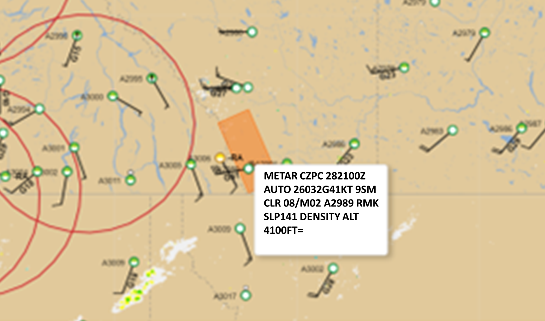
Adequate wind strength is necessary for the generation and maintenance of lee waves and their upward and downward motion of the stable air. This flow must also have strong wind shear in a deep stable layer with increasing winds with height above the mountain top and stability decreasing above the barrier. Lee waves are more likely when the wind direction is roughly perpendicular to the orientation of the barrier. In general, a wind direction within 30° of perpendicular to the barrier is sufficient for lee wave formation.
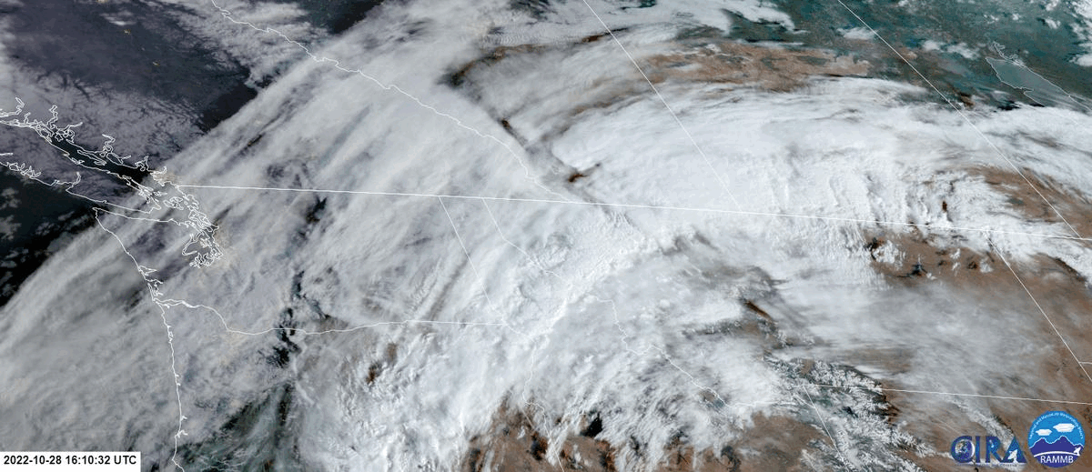
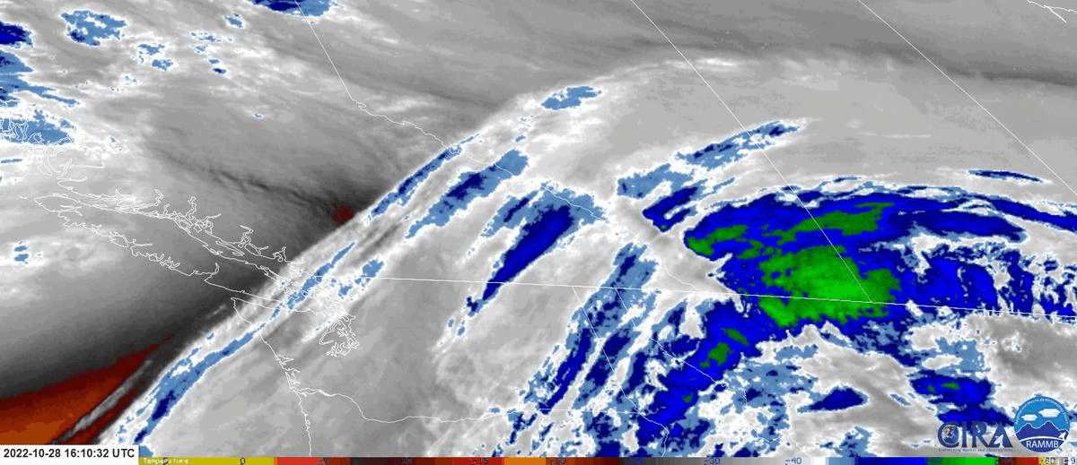
While not a strict requirement, the presence of moisture in the atmosphere can enhance the visibility and cloud formations associated with lee waves. Moisture can contribute to the formation of lenticular clouds, rotor clouds, or other cloud features that accompany lee waves. However, the stability of the air is primarily driven by temperature, so lee waves can still form in relatively dry air.
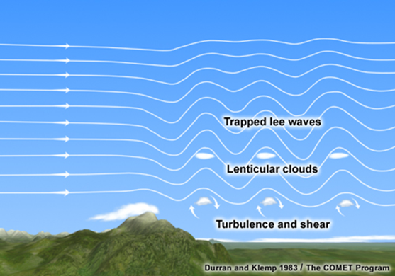
Image Source: COMETOpen a new window
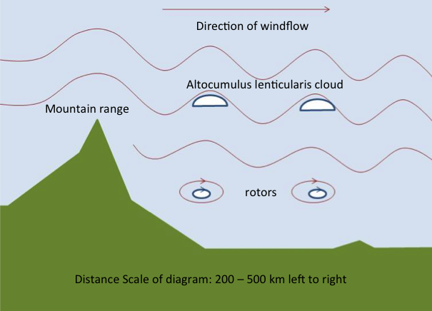
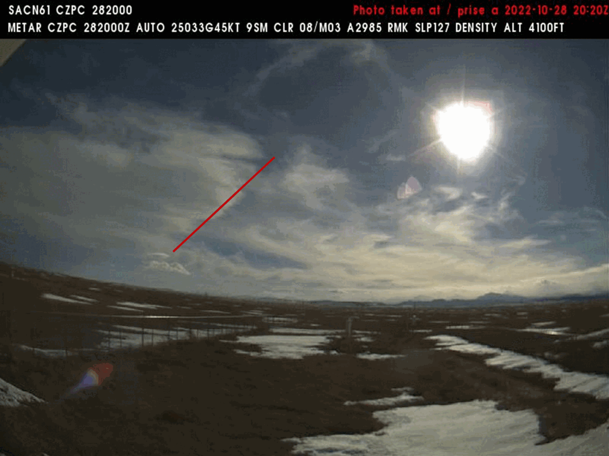
Lee waves consist of alternating crests and troughs, similar to ocean waves. The crests represent the upward movement of air, while the troughs correspond to the downward movement of air. The distance between consecutive crests or troughs is known as the wavelength of the wave. Lee waves have a wavelength of 5-35 km and can persist for hundreds of kilometers downwind of the barrier. Lee waves are usually constrained within a few thousand feet of the mountain top and their amplitude decreases with height.
Lenticular clouds and rotor clouds are often associated with lee waves. Lenticular clouds form when moist air rises and cools as it ascends over the wave crest. Lenticular clouds can be stationary or slowly move with the wind, indicating the presence of a lee wave. Rotor clouds are turbulent clouds that can form beneath the crest of a lee wave. They result from the interaction between the wave and the airflow descending behind the wave crest.
It's important to note that the structure of a lee wave can vary depending on the specific atmospheric conditions, the shape of the mountain or obstruction, and other factors. The wave structure can be influenced by the interaction between the wave and the surrounding airflow, as well as the stability of the atmosphere and moisture content.
This is a depiction of lee waves and the formation of lenticular and rotor clouds. Depending on the moisture aloft lee waves can form alto- or cirro-lenticularis clouds in the wave crests. This leads to a well recognized cloud pattern with bands of lenticular clouds that mirror the profile of the barrier. Rotor clouds may also form beneath the crest of the lee waves.
Image Source: SkybraryOpen a new window